Cigudosa geodata
Cigudosa (Castille and León) is a seat of a third-order administrative division; located in Spain in Europe/Madrid (GMT+2) time zone. With population of 54 people, there are 6416 cities with bigger population in this country. Compared to other cities in Spain, 71.7% of cities are located further ↓South; 66.9% of cities are located further ←West and 64.8% of cities have lower elevation than Cigudosa. Note1
Administrative division(s):
- Level 1: Castille and León
- Level 2: Provincia de Soria
- Level 3: Cigudosa


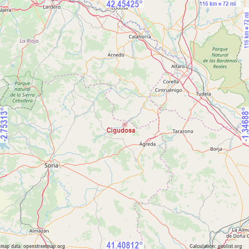
Cigudosa GPS coordinates[2]
41° 55' 59.988" North, 2° 3' 0" West
| Map corner | latitude | longitude |
|---|---|---|
| Upper-left | 42.45425°, | -2.75313° |
| Center: | 41.93333°, | -2.05° |
| Lower-right: | 41.40812°, | -1.34688° |
| Map W x H: | 116.3×116.3 km | = 72.3×72.3mi |
| max Lat: | 43.74134° ⇑28.3% North |
| Cigudosa: | 41.93333° |
| min Lat: | ⇓71.7% South 27.64134° |
| min Long | Cigudosa | max Long |
| -18.00367° | -2.05° | 4.2899° |
| W 66.9%⇐ | ⇒33.1% E |
Elevation
Elevation of Cigudosa is 776 m = 2546 ft, and this is 178 m = 584 ft above average elevation for this country.
| Max E: |
1682 m = 5518 ft | 35.2% |
| Cigudosa | 776 m 2546 ft | |
| Avg. | 598 m = 1962 ft | |
Min E: |
0 m = 0 ft | 64.8% |
See also: Spain elevation on elevation.city.
Geographical zone
Cigudosa is located in North temperate zone (between Tropic of Cancer and the Arctic Circle). Distance of this Northern Tropic circle is 2056.6 km =1277.9 mi to South.| Distance of | km | miles | from Cigudosa |
|---|---|---|---|
| North Pole | 5344.5 | 3320.9 | to North |
| Arctic Circle | 2738.6 | 1701.7 | to North |
| Tropic Cancer | 2056.6 | 1277.9 | to South |
| Equator | 4662.5 | 2897.1 | to South |


Nearby cities:
15 places around Cigudosa: (largest is in red/bold)
• Aguilar del Río Alhama
5.7 km =3.5 mi,  55°
55°
• Castilruiz
6.3 km =3.9 mi,  186°
186°
• Cerbón
9.8 km =6.1 mi,  267°
267°
• Cervera del Río Alhama
11.2 km =7 mi,  44°
44°
• Fuentes de Magaña
10.7 km =6.6 mi, 271°
• Fuentestrún
7.1 km =4.4 mi,  202°
202°
• Magaña
10 km =6.2 mi,  248°
248°
• Matalebreras
10.3 km =6.4 mi,  178°
178°
• Navajún
5.6 km =3.5 mi,  311°
311°
• San Felices
2 km =1.2 mi,  77°
77°
• Valdelagua del Cerro
7.4 km =4.6 mi,  227°
227°
• Valdemadera
6 km =3.7 mi,  340°
340°
• Valdeprado
4.9 km =3 mi,  275°
275°
• Valtajeros
14.3 km =8.9 mi, 272°
• Ágreda
13.6 km =8.5 mi,  129°
129°
Sources, notices
• [Note1] Compared only with cities in Spain existing in our database
• [Src1] Map data: © OpenStreetMap contributors (CC-BY-SA)
• [Src2] Other city data from geonames.org with taken over terms of usage.
• [Src3] Geographical zone / Annual Mean Temperature by Robert A. Rohde @ Wikipedia
