Castil de Peones geodata
Castil de Peones (Castille and León) is a seat of a third-order administrative division; located in Spain in Europe/Madrid (GMT+2) time zone. With population of 26 people, there are 6687 cities with bigger population in this country. Compared to other cities in Spain, 86.8% of cities are located further ↓South; 50.6% of cities are located further →East and 66.8% of cities have lower elevation than Castil de Peones. Note1
Administrative division(s):
- Level 1: Castille and León
- Level 2: Provincia de Burgos
- Level 3: Castil de Peones


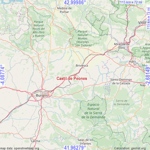
Castil de Peones GPS coordinates[2]
42° 29' 0.492" North, 3° 23' 4.596" West
| Map corner | latitude | longitude |
|---|---|---|
| Upper-left | 42.99986°, | -4.08774° |
| Center: | 42.48347°, | -3.38461° |
| Lower-right: | 41.96279°, | -2.68149° |
| Map W x H: | 115.3×115.3 km | = 71.6×71.6mi |
| max Lat: | 43.74134° ⇑13.2% North |
| Castil de Peones: | 42.48347° |
| min Lat: | ⇓86.8% South 27.64134° |
| min Long | Castil de Peone | max Long |
| -18.00367° | -3.38461° | 4.2899° |
| W 49.4%⇐ | ⇒50.6% E |
Elevation
Elevation of Castil de Peones is 790 m = 2592 ft, and this is 192 m = 630 ft above average elevation for this country.
| Max E: |
1682 m = 5518 ft | 33.2% |
| Castil de Peones | 790 m 2592 ft | |
| Avg. | 598 m = 1962 ft | |
Min E: |
0 m = 0 ft | 66.8% |
See also: Spain elevation on elevation.city.
Geographical zone
Castil de Peones is located in North temperate zone (between Tropic of Cancer and the Arctic Circle). Distance of this Northern Tropic circle is 2117.8 km =1315.9 mi to South.| Distance of | km | miles | from Castil de Peones |
|---|---|---|---|
| North Pole | 5283.3 | 3282.9 | to North |
| Arctic Circle | 2677.5 | 1663.7 | to North |
| Tropic Cancer | 2117.8 | 1315.9 | to South |
| Equator | 4723.7 | 2935.2 | to South |


Nearby cities:
15 places around Castil de Peones: (largest is in red/bold)
• Alcocero de Mola
2.5 km =1.6 mi,  119°
119°
• Arraya de Oca
7.7 km =4.8 mi,  188°
188°
• Bañuelos de Bureba
8.9 km =5.5 mi,  76°
76°
• Briviesca
8.9 km =5.5 mi,  34°
34°
• Carrias
8.3 km =5.2 mi,  91°
91°
• Cerratón de Juarros
6.9 km =4.3 mi,  172°
172°
• Galbarros
6.6 km =4.1 mi,  317°
317°
• Monasterio de Rodilla
7.5 km =4.7 mi,  247°
247°
• Prádanos de Bureba
3.7 km =2.3 mi,  54°
54°
• Quintanavides
3.3 km =2.1 mi,  264°
264°
• Reinoso
2.9 km =1.8 mi,  359°
359°
• Salinillas de Bureba
7.7 km =4.8 mi, 358°
• Santa María del Invierno
6.3 km =3.9 mi,  224°
224°
• Santa Olalla de Bureba
4.7 km =2.9 mi, 261°
• Villaescusa la Sombría
8.1 km =5 mi,  200°
200°
Sources, notices
• [Note1] Compared only with cities in Spain existing in our database
• [Src1] Map data: © OpenStreetMap contributors (CC-BY-SA)
• [Src2] Other city data from geonames.org with taken over terms of usage.
• [Src3] Geographical zone / Annual Mean Temperature by Robert A. Rohde @ Wikipedia
