Reinoso geodata
Reinoso (Castille and León) is a seat of a third-order administrative division; located in Spain in Europe/Madrid (GMT+2) time zone. With population of 21 people, there are 6716 cities with bigger population in this country. Compared to other cities in Spain, 87.4% of cities are located further ↓South; 50.6% of cities are located further →East and 79.5% of cities have lower elevation than Reinoso. Note1
Administrative division(s):
- Level 1: Castille and León
- Level 2: Provincia de Burgos
- Level 3: Reinoso


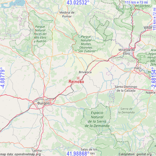
Reinoso GPS coordinates[2]
42° 30' 32.94" North, 3° 23' 4.776" West
| Map corner | latitude | longitude |
|---|---|---|
| Upper-left | 43.02532°, | -4.08779° |
| Center: | 42.50915°, | -3.38466° |
| Lower-right: | 41.98868°, | -2.68154° |
| Map W x H: | 115.3×115.3 km | = 71.6×71.6mi |
| max Lat: | 43.74134° ⇑12.6% North |
| Reinoso: | 42.50915° |
| min Lat: | ⇓87.4% South 27.64134° |
| min Long | Reinoso | max Long |
| -18.00367° | -3.38466° | 4.2899° |
| W 49.4%⇐ | ⇒50.6% E |
Elevation
Elevation of Reinoso is 893 m = 2930 ft, and this is 295 m = 968 ft above average elevation for this country.
| Max E: |
1682 m = 5518 ft | 20.5% |
| Reinoso | 893 m 2930 ft | |
| Avg. | 598 m = 1962 ft | |
Min E: |
0 m = 0 ft | 79.5% |
See also: Spain elevation on elevation.city.
Geographical zone
Reinoso is located in North temperate zone (between Tropic of Cancer and the Arctic Circle). Distance of this Northern Tropic circle is 2120.7 km =1317.7 mi to South.| Distance of | km | miles | from Reinoso |
|---|---|---|---|
| North Pole | 5280.5 | 3281.1 | to North |
| Arctic Circle | 2674.6 | 1661.9 | to North |
| Tropic Cancer | 2120.7 | 1317.7 | to South |
| Equator | 4726.6 | 2937 | to South |


Nearby cities:
15 places around Reinoso: (largest is in red/bold)
• Alcocero de Mola
4.7 km =2.9 mi,  151°
151°
• Bañuelos de Bureba
8.6 km =5.3 mi,  94°
94°
• Briviesca
6.8 km =4.2 mi,  48°
48°
• Carrias
8.9 km =5.5 mi,  110°
110°
• Castil de Peones
2.9 km =1.8 mi,  179°
179°
• Galbarros
4.8 km =3 mi,  294°
294°
• Monasterio de Rodilla
9 km =5.6 mi,  230°
230°
• Piérnigas
9.3 km =5.8 mi,  345°
345°
• Prádanos de Bureba
3.1 km =1.9 mi,  103°
103°
• Quintanabureba
8.7 km =5.4 mi,  9°
9°
• Quintanavides
4.5 km =2.8 mi, 226°
• Rojas
9 km =5.6 mi,  328°
328°
• Salinillas de Bureba
4.8 km =3 mi,  357°
357°
• Santa María del Invierno
8.6 km =5.3 mi,  210°
210°
• Santa Olalla de Bureba
5.8 km =3.6 mi, 232°
Sources, notices
• [Note1] Compared only with cities in Spain existing in our database
• [Src1] Map data: © OpenStreetMap contributors (CC-BY-SA)
• [Src2] Other city data from geonames.org with taken over terms of usage.
• [Src3] Geographical zone / Annual Mean Temperature by Robert A. Rohde @ Wikipedia
