Aldeasoña geodata
Aldeasoña (Castille and León) is a seat of a third-order administrative division; located in Spain in Europe/Madrid (GMT+2) time zone. With population of 77 people, there are 6173 cities with bigger population in this country. Compared to other cities in Spain, 60.1% of cities are located further ↓South; 60.7% of cities are located further →East and 74.9% of cities have lower elevation than Aldeasoña. Note1
Administrative division(s):
- Level 1: Castille and León
- Level 2: Provincia de Segovia
- Level 3: Aldeasoña


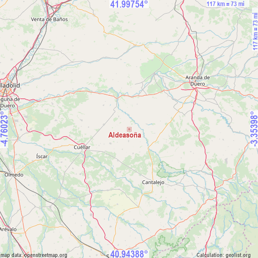
Aldeasoña GPS coordinates[2]
41° 28' 22.26" North, 4° 3' 25.596" West
| Map corner | latitude | longitude |
|---|---|---|
| Upper-left | 41.99754°, | -4.76023° |
| Center: | 41.47285°, | -4.05711° |
| Lower-right: | 40.94388°, | -3.35398° |
| Map W x H: | 117.2×117.2 km | = 72.8×72.8mi |
| max Lat: | 43.74134° ⇑39.9% North |
| Aldeasoña: | 41.47285° |
| min Lat: | ⇓60.1% South 27.64134° |
| min Long | Aldeasoña | max Long |
| -18.00367° | -4.05711° | 4.2899° |
| W 39.3%⇐ | ⇒60.7% E |
Elevation
Elevation of Aldeasoña is 850 m = 2789 ft, and this is 252 m = 827 ft above average elevation for this country.
| Max E: |
1682 m = 5518 ft | 25.1% |
| Aldeasoña | 850 m 2789 ft | |
| Avg. | 598 m = 1962 ft | |
Min E: |
0 m = 0 ft | 74.9% |
See also: Spain elevation on elevation.city.
Geographical zone
Aldeasoña is located in North temperate zone (between Tropic of Cancer and the Arctic Circle). Distance of this Northern Tropic circle is 2005.4 km =1246.1 mi to South.| Distance of | km | miles | from Aldeasoña |
|---|---|---|---|
| North Pole | 5395.7 | 3352.7 | to North |
| Arctic Circle | 2789.8 | 1733.5 | to North |
| Tropic Cancer | 2005.4 | 1246.1 | to South |
| Equator | 4611.3 | 2865.3 | to South |


Nearby cities:
15 places around Aldeasoña: (largest is in red/bold)
• Canalejas de Peñafiel
7.6 km =4.7 mi,  320°
320°
• Cozuelos de Fuentidueña
9.7 km =6 mi,  199°
199°
• Cuevas de Provanco
11 km =6.8 mi,  45°
45°
• Fompedraza
10.1 km =6.3 mi,  313°
313°
• Fuentepiñel
8.3 km =5.2 mi,  171°
171°
• Fuentesaúco de Fuentidueña
5.4 km =3.4 mi,  184°
184°
• Fuentidueña
7.3 km =4.5 mi,  117°
117°
• Laguna de Contreras
3.4 km =2.1 mi,  43°
43°
• Membibre de la Hoz
4.1 km =2.5 mi,  231°
231°
• Olmos de Peñafiel
11 km =6.8 mi,  6°
6°
• Olombrada
10.8 km =6.7 mi, 233°
• Rábano
6.7 km =4.2 mi,  356°
356°
• Sacramenia
8.3 km =5.2 mi,  73°
73°
• Torre de Peñafiel
7.5 km =4.7 mi,  339°
339°
• Torrecilla del Pinar
11.1 km =6.9 mi, 171°
Sources, notices
• [Note1] Compared only with cities in Spain existing in our database
• [Src1] Map data: © OpenStreetMap contributors (CC-BY-SA)
• [Src2] Other city data from geonames.org with taken over terms of usage.
• [Src3] Geographical zone / Annual Mean Temperature by Robert A. Rohde @ Wikipedia
