Torre de Peñafiel geodata
Torre de Peñafiel (Castille and León) is a seat of a third-order administrative division; located in Spain in Europe/Madrid (GMT+2) time zone. With population of 54 people, there are 6416 cities with bigger population in this country. Compared to other cities in Spain, 61.8% of cities are located further ↓South; 61% of cities are located further →East and 66.9% of cities have lower elevation than Torre de Peñafiel. Note1
Administrative division(s):
- Level 1: Castille and León
- Level 2: Provincia de Valladolid
- Level 3: Torre de Peñafiel


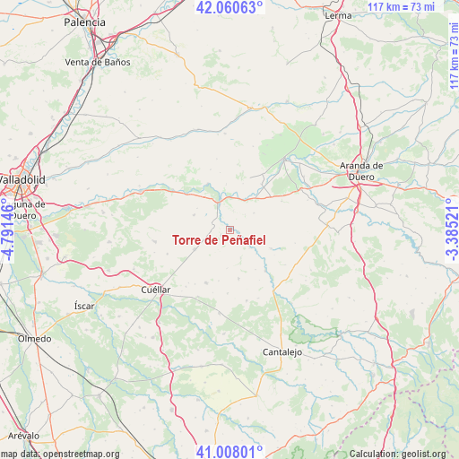
Torre de Peñafiel GPS coordinates[2]
41° 32' 11.256" North, 4° 5' 17.988" West
| Map corner | latitude | longitude |
|---|---|---|
| Upper-left | 42.06063°, | -4.79146° |
| Center: | 41.53646°, | -4.08833° |
| Lower-right: | 41.00801°, | -3.38521° |
| Map W x H: | 117×117 km | = 72.7×72.7mi |
| max Lat: | 43.74134° ⇑38.2% North |
| Torre de Peñafiel: | 41.53646° |
| min Lat: | ⇓61.8% South 27.64134° |
| min Long | Torre de Peñaf | max Long |
| -18.00367° | -4.08833° | 4.2899° |
| W 39%⇐ | ⇒61% E |
Elevation
Elevation of Torre de Peñafiel is 791 m = 2595 ft, and this is 193 m = 633 ft above average elevation for this country.
| Max E: |
1682 m = 5518 ft | 33.1% |
| Torre de Peñafiel | 791 m 2595 ft | |
| Avg. | 598 m = 1962 ft | |
Min E: |
0 m = 0 ft | 66.9% |
See also: Spain elevation on elevation.city.
Geographical zone
Torre de Peñafiel is located in North temperate zone (between Tropic of Cancer and the Arctic Circle). Distance of this Northern Tropic circle is 2012.5 km =1250.5 mi to South.| Distance of | km | miles | from Torre de Peñafiel |
|---|---|---|---|
| North Pole | 5388.6 | 3348.3 | to North |
| Arctic Circle | 2782.8 | 1729.2 | to North |
| Tropic Cancer | 2012.5 | 1250.5 | to South |
| Equator | 4618.4 | 2869.7 | to South |


Nearby cities:
15 places around Torre de Peñafiel: (largest is in red/bold)
• Aldeasoña
7.5 km =4.7 mi,  159°
159°
• Bocos de Duero
9.8 km =6.1 mi,  8°
8°
• Campaspero
10.2 km =6.3 mi,  241°
241°
• Canalejas de Peñafiel
2.6 km =1.6 mi, 240°
• Castrillo de Duero
7.4 km =4.6 mi,  54°
54°
• Cuevas de Provanco
10.5 km =6.5 mi,  86°
86°
• Fompedraza
4.7 km =2.9 mi,  268°
268°
• Laguna de Contreras
6.8 km =4.2 mi,  132°
132°
• Langayo
9.9 km =6.2 mi,  292°
292°
• Manzanillo
10 km =6.2 mi,  303°
303°
• Membibre de la Hoz
9.7 km =6 mi,  183°
183°
• Olmos de Peñafiel
5.4 km =3.4 mi,  44°
44°
• Peñafiel
7.6 km =4.7 mi,  343°
343°
• Rábano
2.2 km =1.4 mi,  99°
99°
• Sacramenia
11.5 km =7.1 mi,  114°
114°
Sources, notices
• [Note1] Compared only with cities in Spain existing in our database
• [Src1] Map data: © OpenStreetMap contributors (CC-BY-SA)
• [Src2] Other city data from geonames.org with taken over terms of usage.
• [Src3] Geographical zone / Annual Mean Temperature by Robert A. Rohde @ Wikipedia
