Villers-la-Montagne geodata
Villers-la-Montagne (Grand Est) is a populated place; located in France in Europe/Paris (GMT+2) time zone. With population of 1,373 people, there are 6715 cities with bigger population in this country. Compared to other cities in France, 88.9% of cities are located further ↓South; 85.3% of cities are located further ←West and 88.1% of cities have lower elevation than Villers-la-Montagne. Note1
Administrative division(s):
- Level 1: Grand Est
- Level 2: Meurthe-et-Moselle
- Level 3: Arrondissement de Briey
- Level 4: Villers-la-Montagne


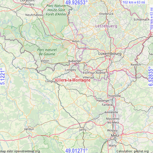
Villers-la-Montagne GPS coordinates[2]
49° 28' 18.3" North, 5° 49' 30.792" East
| Map corner | latitude | longitude |
|---|---|---|
| Upper-left | 49.92653°, | 5.1221° |
| Center: | 49.47175°, | 5.82522° |
| Lower-right: | 49.01271°, | 6.52835° |
| Map W x H: | 101.6×101.6 km | = 63.1×63.1mi |
| max Lat: | 51.07786° ⇑11.1% North |
| Villers-la-Montagne: | 49.47175° |
| min Lat: | ⇓88.9% South 41.3874° |
| min Long | Villers-la-Mont | max Long |
| -5.08615° | 5.82522° | 9.52242° |
| W 85.3%⇐ | ⇒14.7% E |
Elevation
Elevation of Villers-la-Montagne is 390 m = 1280 ft, and this is 196.3 m = 644 ft above average elevation for this country.
| Max E: |
2333 m = 7654 ft | 11.9% |
| Villers-la-Montagne | 390 m 1280 ft | |
| Avg. | 193.7 m = 635 ft | |
Min E: |
-1 m = -3 ft | 88.1% |
See also: France elevation on elevation.city.
Geographical zone
Villers-la-Montagne is located in North temperate zone (between Tropic of Cancer and the Arctic Circle). Distance of this North polar circle is 1900.4 km =1180.9 mi to North.| Distance of | km | miles | from Villers-la-Montagne |
|---|---|---|---|
| North Pole | 4506.3 | 2800.1 | to North |
| Arctic Circle | 1900.4 | 1180.9 | to North |
| Tropic Cancer | 2894.8 | 1798.7 | to South |
| Equator | 5500.7 | 3418 | to South |


Nearby cities:
15 places around Villers-la-Montagne: (largest is in red/bold)
• Baslieux
6.4 km =4 mi,  228°
228°
• Chenières
4.3 km =2.7 mi,  271°
271°
• Cutry
6 km =3.7 mi,  282°
282°
• Haucourt
2.5 km =1.6 mi,  322°
322°
• Herserange
6 km =3.7 mi,  334°
334°
• Hussigny-Godbrange
3.9 km =2.4 mi,  50°
50°
• Longlaville
7.2 km =4.5 mi,  345°
345°
• Longwy
7.2 km =4.5 mi, 320°
• Mexy
4.5 km =2.8 mi, 315°
• Morfontaine
3.2 km =2 mi,  199°
199°
• Rédange
7.2 km =4.5 mi,  70°
70°
• Réhon
5.9 km =3.7 mi,  300°
300°
• Saulnes
6.7 km =4.2 mi,  357°
357°
• Thil
6 km =3.7 mi,  88°
88°
• Tiercelet
4.3 km =2.7 mi,  104°
104°
Sources, notices
• [Note1] Compared only with cities in France existing in our database
• [Src1] Map data: © OpenStreetMap contributors (CC-BY-SA)
• [Src2] Other city data from geonames.org with taken over terms of usage.
• [Src3] Geographical zone / Annual Mean Temperature by Robert A. Rohde @ Wikipedia
