Thourotte geodata
Thourotte (Hauts-de-France) is a populated place; located in France in Europe/Paris (GMT+2) time zone. With population of 5,581 people, there are 1775 cities with bigger population in this country. Compared to other cities in France, 88.9% of cities are located further ↓South; 56.2% of cities are located further ←West and 87.8% of cities have higher elevation than Thourotte. Note1
Administrative division(s):
- Level 1: Hauts-de-France
- Level 2: Département de l'Oise
- Level 3: Arrondissement de Compiègne
- Level 4: Thourotte


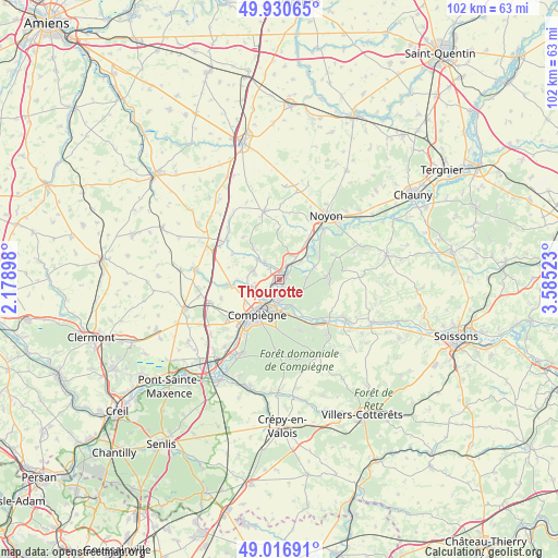
Thourotte GPS coordinates[2]
49° 28' 33.276" North, 2° 52' 55.56" East
| Map corner | latitude | longitude |
|---|---|---|
| Upper-left | 49.93065°, | 2.17898° |
| Center: | 49.47591°, | 2.8821° |
| Lower-right: | 49.01691°, | 3.58523° |
| Map W x H: | 101.6×101.6 km | = 63.1×63.1mi |
| max Lat: | 51.07786° ⇑11.1% North |
| Thourotte: | 49.47591° |
| min Lat: | ⇓88.9% South 41.3874° |
| min Long | Thourotte | max Long |
| -5.08615° | 2.8821° | 9.52242° |
| W 56.2%⇐ | ⇒43.8% E |
Elevation
Elevation of Thourotte is 35 m = 115 ft, and this is 158.7 m = 521 ft below average elevation for this country.
| Max E: |
2333 m = 7654 ft | 87.8% |
| Avg. | 193.7 m = 635 ft | |
| Thourotte | 35 m = 115 ft | |
Min E: |
-1 m = -3 ft | 12.2% |
See also: France elevation on elevation.city.
Geographical zone
Thourotte is located in North temperate zone (between Tropic of Cancer and the Arctic Circle). Distance of this North polar circle is 1900 km =1180.6 mi to North.| Distance of | km | miles | from Thourotte |
|---|---|---|---|
| North Pole | 4505.9 | 2799.8 | to North |
| Arctic Circle | 1900 | 1180.6 | to North |
| Tropic Cancer | 2895.3 | 1799.1 | to South |
| Equator | 5501.2 | 3418.3 | to South |


Nearby cities:
15 places around Thourotte: (largest is in red/bold)
• Cambronne-lès-Ribécourt
3.7 km =2.3 mi,  18°
18°
• Chevincourt
4.4 km =2.7 mi,  320°
320°
• Choisy-au-Bac
4.3 km =2.7 mi,  184°
184°
• Clairoix
4.5 km =2.8 mi,  214°
214°
• Coudun
5.3 km =3.3 mi,  252°
252°
• Dreslincourt
6.6 km =4.1 mi,  29°
29°
• Giraumont
4.5 km =2.8 mi,  263°
263°
• Janville
2.8 km =1.7 mi, 213°
• Le Plessis-Brion
1.5 km =0.9 mi,  153°
153°
• Longueil-Annel
1.5 km =0.9 mi,  238°
238°
• Machemont
2.6 km =1.6 mi,  338°
338°
• Montmacq
1.6 km =1 mi,  66°
66°
• Pimprez
6.6 km =4.1 mi,  49°
49°
• Saint-Léger-aux-Bois
5.4 km =3.4 mi,  81°
81°
• Villers-sur-Coudun
5.7 km =3.5 mi,  278°
278°
Sources, notices
• [Note1] Compared only with cities in France existing in our database
• [Src1] Map data: © OpenStreetMap contributors (CC-BY-SA)
• [Src2] Other city data from geonames.org with taken over terms of usage.
• [Src3] Geographical zone / Annual Mean Temperature by Robert A. Rohde @ Wikipedia
