Pimprez geodata
Pimprez (Hauts-de-France) is a populated place; located in France in Europe/Paris (GMT+2) time zone. With population of 670 people, there are 12215 cities with bigger population in this country. Compared to other cities in France, 89.5% of cities are located further ↓South; 57.1% of cities are located further ←West and 83.1% of cities have higher elevation than Pimprez. Note1
Administrative division(s):
- Level 1: Hauts-de-France
- Level 2: Département de l'Oise
- Level 3: Arrondissement de Compiègne
- Level 4: Pimprez


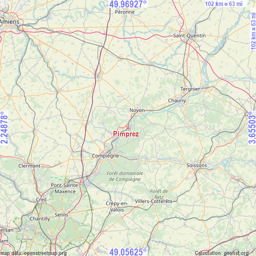
Pimprez GPS coordinates[2]
49° 30' 53.604" North, 2° 57' 6.84" East
| Map corner | latitude | longitude |
|---|---|---|
| Upper-left | 49.96927°, | 2.24878° |
| Center: | 49.51489°, | 2.9519° |
| Lower-right: | 49.05625°, | 3.65503° |
| Map W x H: | 101.5×101.5 km | = 63.1×63.1mi |
| max Lat: | 51.07786° ⇑10.5% North |
| Pimprez: | 49.51489° |
| min Lat: | ⇓89.5% South 41.3874° |
| min Long | Pimprez | max Long |
| -5.08615° | 2.9519° | 9.52242° |
| W 57.1%⇐ | ⇒42.9% E |
Elevation
Elevation of Pimprez is 47 m = 154 ft, and this is 146.7 m = 481 ft below average elevation for this country.
| Max E: |
2333 m = 7654 ft | 83.1% |
| Avg. | 193.7 m = 635 ft | |
| Pimprez | 47 m = 154 ft | |
Min E: |
-1 m = -3 ft | 16.9% |
See also: France elevation on elevation.city.
Geographical zone
Pimprez is located in North temperate zone (between Tropic of Cancer and the Arctic Circle). Distance of this North polar circle is 1895.6 km =1177.9 mi to North.| Distance of | km | miles | from Pimprez |
|---|---|---|---|
| North Pole | 4501.5 | 2797.1 | to North |
| Arctic Circle | 1895.6 | 1177.9 | to North |
| Tropic Cancer | 2899.6 | 1801.7 | to South |
| Equator | 5505.5 | 3421 | to South |


Nearby cities:
15 places around Pimprez: (largest is in red/bold)
• Bailly
2.5 km =1.6 mi,  148°
148°
• Cambronne-lès-Ribécourt
4 km =2.5 mi,  257°
257°
• Cannectancourt
5.9 km =3.7 mi,  322°
322°
• Carlepont
5.2 km =3.2 mi,  90°
90°
• Chiry-Ourscamp
3.2 km =2 mi,  353°
353°
• Dreslincourt
2.3 km =1.4 mi,  309°
309°
• Le Plessis-Brion
7.2 km =4.5 mi,  217°
217°
• Machemont
6.3 km =3.9 mi,  252°
252°
• Montmacq
5.1 km =3.2 mi, 224°
• Saint-Léger-aux-Bois
3.5 km =2.2 mi,  175°
175°
• Sempigny
5.8 km =3.6 mi,  32°
32°
• Thourotte
6.6 km =4.1 mi,  229°
229°
• Tracy-le-Mont
6.3 km =3.9 mi,  138°
138°
• Tracy-le-Val
5.1 km =3.2 mi,  125°
125°
• Ville
4.3 km =2.7 mi, 347°
Sources, notices
• [Note1] Compared only with cities in France existing in our database
• [Src1] Map data: © OpenStreetMap contributors (CC-BY-SA)
• [Src2] Other city data from geonames.org with taken over terms of usage.
• [Src3] Geographical zone / Annual Mean Temperature by Robert A. Rohde @ Wikipedia
