Tacoignières geodata
Tacoignières (Île-de-France) is a populated place; located in France in Europe/Paris (GMT+2) time zone. With population of 1,003 people, there are 8818 cities with bigger population in this country. Compared to other cities in France, 76.3% of cities are located further ↓South; 60.7% of cities are located further →East and 53.6% of cities have lower elevation than Tacoignières. Note1
Administrative division(s):
- Level 1: Île-de-France
- Level 2: Yvelines
- Level 3: Arrondissement de Mantes-la-Jolie
- Level 4: Tacoignières


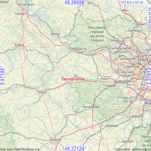
Tacoignières GPS coordinates[2]
48° 50' 10.284" North, 1° 40' 30.036" East
| Map corner | latitude | longitude |
|---|---|---|
| Upper-left | 49.29686°, | 0.97188° |
| Center: | 48.83619°, | 1.67501° |
| Lower-right: | 48.37124°, | 2.37813° |
| Map W x H: | 102.9×102.9 km | = 63.9×63.9mi |
| max Lat: | 51.07786° ⇑23.7% North |
| Tacoignières: | 48.83619° |
| min Lat: | ⇓76.3% South 41.3874° |
| min Long | Tacoignières | max Long |
| -5.08615° | 1.67501° | 9.52242° |
| W 39.3%⇐ | ⇒60.7% E |
Elevation
Elevation of Tacoignières is 145 m = 476 ft, and this is 48.7 m = 160 ft below average elevation for this country.
| Max E: |
2333 m = 7654 ft | 46.4% |
| Avg. | 193.7 m = 635 ft | |
| Tacoignières | 145 m = 476 ft | |
Min E: |
-1 m = -3 ft | 53.6% |
See also: France elevation on elevation.city.
Geographical zone
Tacoignières is located in North temperate zone (between Tropic of Cancer and the Arctic Circle). Distance of this North polar circle is 1971.1 km =1224.8 mi to North.| Distance of | km | miles | from Tacoignières |
|---|---|---|---|
| North Pole | 4577 | 2844 | to North |
| Arctic Circle | 1971.1 | 1224.8 | to North |
| Tropic Cancer | 2824.2 | 1754.9 | to South |
| Equator | 5430.1 | 3374.1 | to South |


Nearby cities:
15 places around Tacoignières: (largest is in red/bold)
• Arnouville-lès-Mantes
9.2 km =5.7 mi,  26°
26°
• Bazainville
3.6 km =2.2 mi,  189°
189°
• Dammartin-en-Serve
8.5 km =5.3 mi,  331°
331°
• Flexanville
5 km =3.1 mi,  67°
67°
• Gambais
7 km =4.3 mi,  181°
181°
• Garancières
6.1 km =3.8 mi,  104°
104°
• Grosrouvre
8.7 km =5.4 mi,  133°
133°
• Houdan
7.5 km =4.7 mi,  227°
227°
• La Queue-les-Yvelines
7.8 km =4.8 mi,  120°
120°
• Maulette
6.2 km =3.9 mi,  219°
219°
• Orgerus
1.9 km =1.2 mi,  82°
82°
• Perdreauville
4.4 km =2.7 mi,  173°
173°
• Saint-Lubin-de-la-Haye
7.8 km =4.8 mi,  255°
255°
• Septeuil
6.3 km =3.9 mi,  5°
5°
• Villiers-le-Mahieu
7.6 km =4.7 mi, 68°
Sources, notices
• [Note1] Compared only with cities in France existing in our database
• [Src1] Map data: © OpenStreetMap contributors (CC-BY-SA)
• [Src2] Other city data from geonames.org with taken over terms of usage.
• [Src3] Geographical zone / Annual Mean Temperature by Robert A. Rohde @ Wikipedia
