Sommedieue geodata
Sommedieue (Grand Est) is a populated place; located in France in Europe/Paris (GMT+2) time zone. With population of 998 people, there are 8844 cities with bigger population in this country. Compared to other cities in France, 81.8% of cities are located further ↓South; 82.6% of cities are located further ←West and 71.8% of cities have lower elevation than Sommedieue. Note1
Administrative division(s):
- Level 1: Grand Est
- Level 2: Meuse
- Level 3: Arrondissement de Verdun
- Level 4: Sommedieue


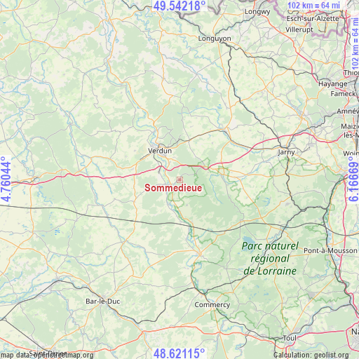
Sommedieue GPS coordinates[2]
49° 5' 1.68" North, 5° 27' 48.816" East
| Map corner | latitude | longitude |
|---|---|---|
| Upper-left | 49.54218°, | 4.76044° |
| Center: | 49.0838°, | 5.46356° |
| Lower-right: | 48.62115°, | 6.16669° |
| Map W x H: | 102.4×102.4 km | = 63.6×63.6mi |
| max Lat: | 51.07786° ⇑18.2% North |
| Sommedieue: | 49.0838° |
| min Lat: | ⇓81.8% South 41.3874° |
| min Long | Sommedieue | max Long |
| -5.08615° | 5.46356° | 9.52242° |
| W 82.6%⇐ | ⇒17.4% E |
Elevation
Elevation of Sommedieue is 229 m = 751 ft, and this is 35.3 m = 116 ft above average elevation for this country.
| Max E: |
2333 m = 7654 ft | 28.2% |
| Sommedieue | 229 m 751 ft | |
| Avg. | 193.7 m = 635 ft | |
Min E: |
-1 m = -3 ft | 71.8% |
See also: France elevation on elevation.city.
Geographical zone
Sommedieue is located in North temperate zone (between Tropic of Cancer and the Arctic Circle). Distance of this North polar circle is 1943.6 km =1207.7 mi to North.| Distance of | km | miles | from Sommedieue |
|---|---|---|---|
| North Pole | 4549.5 | 2826.9 | to North |
| Arctic Circle | 1943.6 | 1207.7 | to North |
| Tropic Cancer | 2851.7 | 1772 | to South |
| Equator | 5457.6 | 3391.2 | to South |


Nearby cities:
15 places around Sommedieue: (largest is in red/bold)
• Ancemont
4.4 km =2.7 mi,  247°
247°
• Belleville-sur-Meuse
12.5 km =7.8 mi,  327°
327°
• Bras-sur-Meuse
15.4 km =9.6 mi,  335°
335°
• Buzy-Darmont
19.5 km =12.1 mi,  61°
61°
• Dieue-sur-Meuse
3.3 km =2.1 mi, 246°
• Dugny-sur-Meuse
6.4 km =4 mi,  296°
296°
• Fresnes-en-Woëvre
12.2 km =7.6 mi,  83°
83°
• Hannonville-sous-les-Côtes
15.1 km =9.4 mi,  107°
107°
• Haudainville
5.6 km =3.5 mi, 327°
• Lacroix-sur-Meuse
12.8 km =8 mi,  164°
164°
• Rouvres-en-Woëvre
22.3 km =13.9 mi,  47°
47°
• Thierville-sur-Meuse
12.6 km =7.8 mi,  320°
320°
• Verdun
10.3 km =6.4 mi, 325°
• Vigneulles-lès-Hattonchâtel
20.9 km =13 mi,  122°
122°
• Étain
19.2 km =11.9 mi,  41°
41°
Sources, notices
• [Note1] Compared only with cities in France existing in our database
• [Src1] Map data: © OpenStreetMap contributors (CC-BY-SA)
• [Src2] Other city data from geonames.org with taken over terms of usage.
• [Src3] Geographical zone / Annual Mean Temperature by Robert A. Rohde @ Wikipedia
