Rouvres-en-Woëvre geodata
Rouvres-en-Woëvre (Grand Est) is a populated place; located in France in Europe/Paris (GMT+2) time zone. With population of 622 people, there are 12950 cities with bigger population in this country. Compared to other cities in France, 84.6% of cities are located further ↓South; 84.3% of cities are located further ←West and 71.4% of cities have lower elevation than Rouvres-en-Woëvre. Note1
Administrative division(s):
- Level 1: Grand Est
- Level 2: Meuse
- Level 3: Arrondissement de Verdun
- Level 4: Rouvres-en-Woëvre


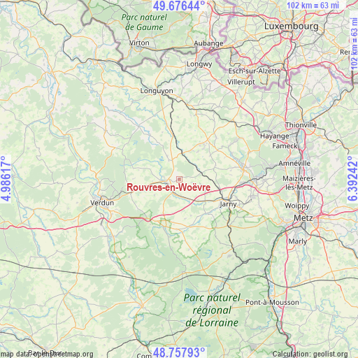
Rouvres-en-Woëvre GPS coordinates[2]
49° 13' 9.552" North, 5° 41' 21.444" East
| Map corner | latitude | longitude |
|---|---|---|
| Upper-left | 49.67644°, | 4.98617° |
| Center: | 49.21932°, | 5.68929° |
| Lower-right: | 48.75793°, | 6.39242° |
| Map W x H: | 102.1×102.1 km | = 63.4×63.4mi |
| max Lat: | 51.07786° ⇑15.4% North |
| Rouvres-en-Woëvre: | 49.21932° |
| min Lat: | ⇓84.6% South 41.3874° |
| min Long | Rouvres-en-Woë | max Long |
| -5.08615° | 5.68929° | 9.52242° |
| W 84.3%⇐ | ⇒15.7% E |
Elevation
Elevation of Rouvres-en-Woëvre is 226 m = 741 ft, and this is 32.3 m = 106 ft above average elevation for this country.
| Max E: |
2333 m = 7654 ft | 28.6% |
| Rouvres-en-Woëvre | 226 m 741 ft | |
| Avg. | 193.7 m = 635 ft | |
Min E: |
-1 m = -3 ft | 71.4% |
See also: France elevation on elevation.city.
Geographical zone
Rouvres-en-Woëvre is located in North temperate zone (between Tropic of Cancer and the Arctic Circle). Distance of this North polar circle is 1928.5 km =1198.3 mi to North.| Distance of | km | miles | from Rouvres-en-Woëvre |
|---|---|---|---|
| North Pole | 4534.4 | 2817.5 | to North |
| Arctic Circle | 1928.5 | 1198.3 | to North |
| Tropic Cancer | 2866.8 | 1781.3 | to South |
| Equator | 5472.7 | 3400.6 | to South |


Nearby cities:
15 places around Rouvres-en-Woëvre: (largest is in red/bold)
• Bouligny
8.9 km =5.5 mi,  25°
25°
• Buzy-Darmont
5.9 km =3.7 mi,  172°
172°
• Conflans-en-Jarnisy
13.4 km =8.3 mi,  115°
115°
• Dommary-Baroncourt
7.2 km =4.5 mi,  8°
8°
• Fresnes-en-Woëvre
14.3 km =8.9 mi,  197°
197°
• Hatrize
16.3 km =10.1 mi,  100°
100°
• Jarny
15.2 km =9.4 mi, 116°
• Joudreville
10.3 km =6.4 mi,  39°
39°
• Labry
14.8 km =9.2 mi,  110°
110°
• Landres
13.8 km =8.6 mi, 35°
• Lantéfontaine
16 km =9.9 mi,  78°
78°
• Mont-Bonvillers
16 km =9.9 mi, 41°
• Piennes
12 km =7.5 mi, 33°
• Spincourt
12.5 km =7.8 mi,  352°
352°
• Étain
3.6 km =2.2 mi,  258°
258°
Sources, notices
• [Note1] Compared only with cities in France existing in our database
• [Src1] Map data: © OpenStreetMap contributors (CC-BY-SA)
• [Src2] Other city data from geonames.org with taken over terms of usage.
• [Src3] Geographical zone / Annual Mean Temperature by Robert A. Rohde @ Wikipedia
