Sombacour geodata
Sombacour (Bourgogne-Franche-Comté) is a populated place; located in France in Europe/Paris (GMT+2) time zone. With population of 553 people, there are 14157 cities with bigger population in this country. Compared to other cities in France, 55.8% of cities are located further ↑North; 89.8% of cities are located further ←West and 97.3% of cities have lower elevation than Sombacour. Note1
Administrative division(s):
- Level 1: Bourgogne-Franche-Comté
- Level 2: Doubs
- Level 3: Arrondissement de Pontarlier
- Level 4: Sombacour


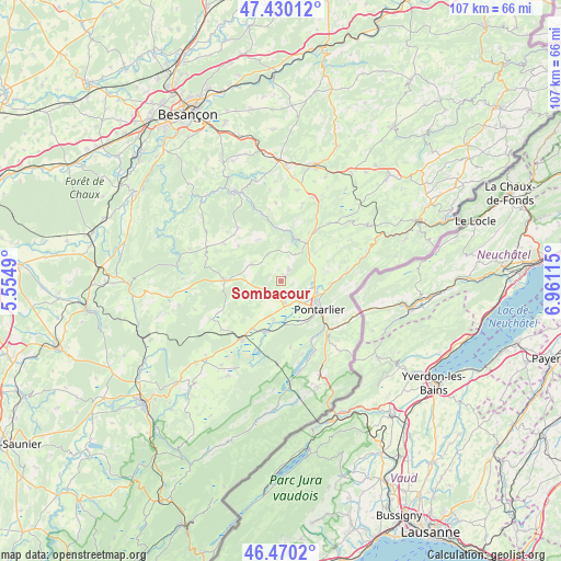
Sombacour GPS coordinates[2]
46° 57' 8.316" North, 6° 15' 28.908" East
| Map corner | latitude | longitude |
|---|---|---|
| Upper-left | 47.43012°, | 5.5549° |
| Center: | 46.95231°, | 6.25803° |
| Lower-right: | 46.4702°, | 6.96115° |
| Map W x H: | 106.7×106.7 km | = 66.3×66.3mi |
| max Lat: | 51.07786° ⇑55.8% North |
| Sombacour: | 46.95231° |
| min Lat: | ⇓44.2% South 41.3874° |
| min Long | Sombacour | max Long |
| -5.08615° | 6.25803° | 9.52242° |
| W 89.8%⇐ | ⇒10.2% E |
Elevation
Elevation of Sombacour is 752 m = 2467 ft, and this is 558.3 m = 1832 ft above average elevation for this country.
| Max E: |
2333 m = 7654 ft | 2.7% |
| Sombacour | 752 m 2467 ft | |
| Avg. | 193.7 m = 635 ft | |
Min E: |
-1 m = -3 ft | 97.3% |
See also: France elevation on elevation.city.
Geographical zone
Sombacour is located in North temperate zone (between Tropic of Cancer and the Arctic Circle). Distance of this North polar circle is 2180.6 km =1355 mi to North.| Distance of | km | miles | from Sombacour |
|---|---|---|---|
| North Pole | 4786.5 | 2974.2 | to North |
| Arctic Circle | 2180.6 | 1355 | to North |
| Tropic Cancer | 2614.7 | 1624.7 | to South |
| Equator | 5220.6 | 3243.9 | to South |


Nearby cities:
15 places around Sombacour: (largest is in red/bold)
• Arçon
9.1 km =5.7 mi,  92°
92°
• Bians-les-Usiers
1.9 km =1.2 mi,  43°
43°
• Chaffois
4.6 km =2.9 mi,  165°
165°
• Dommartin
5 km =3.1 mi,  131°
131°
• Doubs
7.6 km =4.7 mi,  111°
111°
• Goux-les-Usiers
2.7 km =1.7 mi,  31°
31°
• Granges-Narboz
9.1 km =5.7 mi,  149°
149°
• Houtaud
5.7 km =3.5 mi,  135°
135°
• La Cluse-et-Mijoux
12.2 km =7.6 mi, 128°
• La Rivière-Drugeon
9.9 km =6.2 mi,  198°
198°
• Levier
10.4 km =6.5 mi,  270°
270°
• Lièvremont
12.7 km =7.9 mi,  81°
81°
• Oye-et-Pallet
12.7 km =7.9 mi, 154°
• Pontarlier
9.2 km =5.7 mi, 126°
• Vuillecin
5.1 km =3.2 mi, 106°
Sources, notices
• [Note1] Compared only with cities in France existing in our database
• [Src1] Map data: © OpenStreetMap contributors (CC-BY-SA)
• [Src2] Other city data from geonames.org with taken over terms of usage.
• [Src3] Geographical zone / Annual Mean Temperature by Robert A. Rohde @ Wikipedia
