Sévignacq-Meyracq geodata
Sévignacq-Meyracq (Nouvelle-Aquitaine) is a populated place; located in France in Europe/Paris (GMT+2) time zone. With population of 579 people, there are 13669 cities with bigger population in this country. Compared to other cities in France, 97.9% of cities are located further ↑North; 82.3% of cities are located further →East and 91.9% of cities have lower elevation than Sévignacq-Meyracq. Note1
Administrative division(s):
- Level 1: Nouvelle-Aquitaine
- Level 2: Département des Pyrénées-Atlantiques
- Level 3: Oloron-Sainte-Marie
- Level 4: Sévignacq-Meyracq


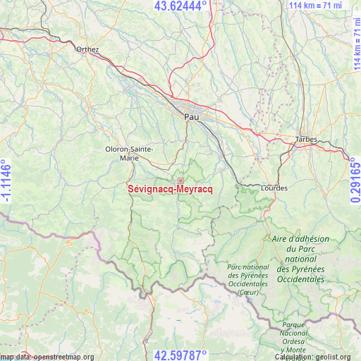
Sévignacq-Meyracq GPS coordinates[2]
43° 6' 47.916" North, 0° 24' 41.292" West
| Map corner | latitude | longitude |
|---|---|---|
| Upper-left | 43.62444°, | -1.1146° |
| Center: | 43.11331°, | -0.41147° |
| Lower-right: | 42.59787°, | 0.29165° |
| Map W x H: | 114.1×114.1 km | = 70.9×70.9mi |
| max Lat: | 51.07786° ⇑97.9% North |
| Sévignacq-Meyracq: | 43.11331° |
| min Lat: | ⇓2.1% South 41.3874° |
| min Long | Sévignacq-Meyr | max Long |
| -5.08615° | -0.41147° | 9.52242° |
| W 17.7%⇐ | ⇒82.3% E |
Elevation
Elevation of Sévignacq-Meyracq is 471 m = 1545 ft, and this is 277.3 m = 910 ft above average elevation for this country.
| Max E: |
2333 m = 7654 ft | 8.1% |
| Sévignacq-Meyracq | 471 m 1545 ft | |
| Avg. | 193.7 m = 635 ft | |
Min E: |
-1 m = -3 ft | 91.9% |
See also: France elevation on elevation.city.
Geographical zone
Sévignacq-Meyracq is located in North temperate zone (between Tropic of Cancer and the Arctic Circle). Distance of this Northern Tropic circle is 2187.8 km =1359.4 mi to South.| Distance of | km | miles | from Sévignacq-Meyracq |
|---|---|---|---|
| North Pole | 5213.3 | 3239.4 | to North |
| Arctic Circle | 2607.4 | 1620.2 | to North |
| Tropic Cancer | 2187.8 | 1359.4 | to South |
| Equator | 4793.8 | 2978.7 | to South |


Nearby cities:
15 places around Sévignacq-Meyracq: (largest is in red/bold)
• Arros-de-Nay
14.2 km =8.8 mi,  47°
47°
• Arthez-d’Asson
13.5 km =8.4 mi,  104°
104°
• Arudy
1.9 km =1.2 mi,  246°
246°
• Asson
13.7 km =8.5 mi,  72°
72°
• Bosdarros
12.1 km =7.5 mi,  17°
17°
• Bruges-Capbis-Mifaget
9.3 km =5.8 mi,  76°
76°
• Buzy
3.8 km =2.4 mi,  305°
305°
• Eysus
14.1 km =8.8 mi,  279°
279°
• Gan
13.5 km =8.4 mi,  9°
9°
• Laruns
14 km =8.7 mi,  185°
185°
• Lasseube
14.6 km =9.1 mi,  336°
336°
• Louvie-Juzon
3.1 km =1.9 mi, 191°
• Nay
14.1 km =8.8 mi,  56°
56°
• Ogeu-les-Bains
8.3 km =5.2 mi,  299°
299°
• Rébénacq
6.4 km =4 mi, 21°
Sources, notices
• [Note1] Compared only with cities in France existing in our database
• [Src1] Map data: © OpenStreetMap contributors (CC-BY-SA)
• [Src2] Other city data from geonames.org with taken over terms of usage.
• [Src3] Geographical zone / Annual Mean Temperature by Robert A. Rohde @ Wikipedia
