Schœnau geodata
Schœnau (Grand Est) is a populated place; located in France in Europe/Paris (GMT+2) time zone. With population of 504 people, there are 15167 cities with bigger population in this country. Compared to other cities in France, 63.2% of cities are located further ↓South; 98.8% of cities are located further ←West and 59.3% of cities have lower elevation than Schœnau. Note1
Administrative division(s):
- Level 1: Grand Est
- Level 2: Bas-Rhin
- Level 3: Arrondissement de Sélestat-Erstein
- Level 4: Schœnau


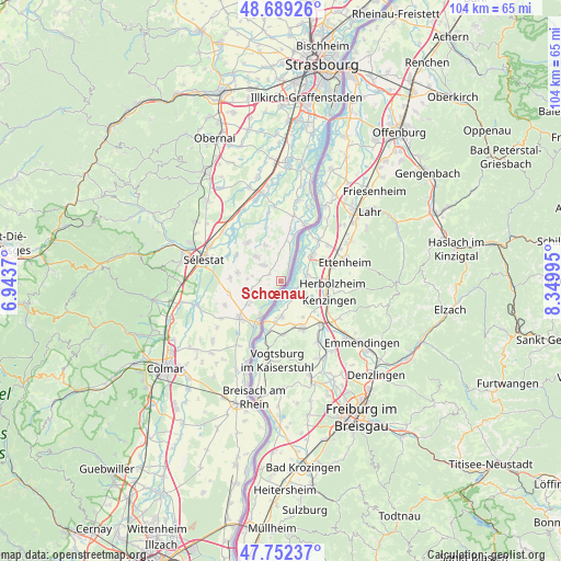
Schœnau GPS coordinates[2]
48° 13' 22.656" North, 7° 38' 48.588" East
| Map corner | latitude | longitude |
|---|---|---|
| Upper-left | 48.68926°, | 6.9437° |
| Center: | 48.22296°, | 7.64683° |
| Lower-right: | 47.75237°, | 8.34995° |
| Map W x H: | 104.2×104.2 km | = 64.7×64.7mi |
| max Lat: | 51.07786° ⇑36.8% North |
| Schœnau: | 48.22296° |
| min Lat: | ⇓63.2% South 41.3874° |
| min Long | Schœnau | max Long |
| -5.08615° | 7.64683° | 9.52242° |
| W 98.8%⇐ | ⇒1.2% E |
Elevation
Elevation of Schœnau is 167 m = 548 ft, and this is 26.7 m = 88 ft below average elevation for this country.
| Max E: |
2333 m = 7654 ft | 40.7% |
| Avg. | 193.7 m = 635 ft | |
| Schœnau | 167 m = 548 ft | |
Min E: |
-1 m = -3 ft | 59.3% |
See also: France elevation on elevation.city.
Geographical zone
Schœnau is located in North temperate zone (between Tropic of Cancer and the Arctic Circle). Distance of this North polar circle is 2039.3 km =1267.2 mi to North.| Distance of | km | miles | from Schœnau |
|---|---|---|---|
| North Pole | 4645.2 | 2886.4 | to North |
| Arctic Circle | 2039.3 | 1267.2 | to North |
| Tropic Cancer | 2756 | 1712.5 | to South |
| Equator | 5361.9 | 3331.7 | to South |


Nearby cities:
15 places around Schœnau: (largest is in red/bold)
• Artolsheim
5.7 km =3.5 mi,  253°
253°
• Baldenheim
8.1 km =5 mi,  281°
281°
• Bindernheim
7.3 km =4.5 mi,  336°
336°
• Diebolsheim
7.6 km =4.7 mi,  9°
9°
• Friesenheim
9.8 km =6.1 mi, 10°
• Hessenheim
7.2 km =4.5 mi,  258°
258°
• Hilsenheim
9.5 km =5.9 mi,  319°
319°
• Mackenheim
7.4 km =4.6 mi,  234°
234°
• Marckolsheim
10 km =6.2 mi, 229°
• Mussig
9.5 km =5.9 mi,  274°
274°
• Muttersholtz
9.6 km =6 mi,  301°
301°
• Ohnenheim
11.3 km =7 mi, 247°
• Saasenheim
2.5 km =1.6 mi,  305°
305°
• Sundhouse
4.4 km =2.7 mi, 314°
• Wittisheim
6.4 km =4 mi, 316°
Sources, notices
• [Note1] Compared only with cities in France existing in our database
• [Src1] Map data: © OpenStreetMap contributors (CC-BY-SA)
• [Src2] Other city data from geonames.org with taken over terms of usage.
• [Src3] Geographical zone / Annual Mean Temperature by Robert A. Rohde @ Wikipedia
