Diebolsheim geodata
Diebolsheim (Grand Est) is a populated place; located in France in Europe/Paris (GMT+2) time zone. With population of 517 people, there are 14885 cities with bigger population in this country. Compared to other cities in France, 64.4% of cities are located further ↓South; 98.9% of cities are located further ←West and 58.3% of cities have lower elevation than Diebolsheim. Note1
Administrative division(s):
- Level 1: Grand Est
- Level 2: Bas-Rhin
- Level 3: Arrondissement de Sélestat-Erstein
- Level 4: Diebolsheim


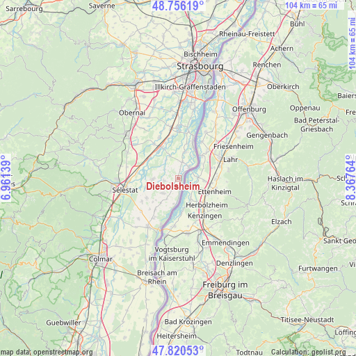
Diebolsheim GPS coordinates[2]
48° 17' 25.8" North, 7° 39' 52.236" East
| Map corner | latitude | longitude |
|---|---|---|
| Upper-left | 48.75619°, | 6.96139° |
| Center: | 48.2905°, | 7.66451° |
| Lower-right: | 47.82053°, | 8.36764° |
| Map W x H: | 104×104 km | = 64.6×64.6mi |
| max Lat: | 51.07786° ⇑35.6% North |
| Diebolsheim: | 48.2905° |
| min Lat: | ⇓64.4% South 41.3874° |
| min Long | Diebolsheim | max Long |
| -5.08615° | 7.66451° | 9.52242° |
| W 98.9%⇐ | ⇒1.1% E |
Elevation
Elevation of Diebolsheim is 162 m = 531 ft, and this is 31.7 m = 104 ft below average elevation for this country.
| Max E: |
2333 m = 7654 ft | 41.7% |
| Avg. | 193.7 m = 635 ft | |
| Diebolsheim | 162 m = 531 ft | |
Min E: |
-1 m = -3 ft | 58.3% |
See also: France elevation on elevation.city.
Geographical zone
Diebolsheim is located in North temperate zone (between Tropic of Cancer and the Arctic Circle). Distance of this North polar circle is 2031.8 km =1262.5 mi to North.| Distance of | km | miles | from Diebolsheim |
|---|---|---|---|
| North Pole | 4637.7 | 2881.7 | to North |
| Arctic Circle | 2031.8 | 1262.5 | to North |
| Tropic Cancer | 2763.5 | 1717.2 | to South |
| Equator | 5369.4 | 3336.4 | to South |


Nearby cities:
15 places around Diebolsheim: (largest is in red/bold)
• Bindernheim
4.3 km =2.7 mi,  259°
259°
• Boofzheim
4.8 km =3 mi,  14°
14°
• Friesenheim
2.1 km =1.3 mi, 12°
• Herbsheim
7 km =4.3 mi,  339°
339°
• Hilsenheim
7.5 km =4.7 mi,  267°
267°
• Huttenheim
9.9 km =6.2 mi,  319°
319°
• Muttersholtz
9.9 km =6.2 mi, 255°
• Obenheim
8 km =5 mi, 14°
• Rhinau
4.5 km =2.8 mi,  42°
42°
• Rossfeld
6.4 km =4 mi,  326°
326°
• Saasenheim
6.9 km =4.3 mi,  209°
209°
• Schœnau
7.6 km =4.7 mi,  189°
189°
• Sermersheim
10.3 km =6.4 mi,  306°
306°
• Sundhouse
6.3 km =3.9 mi,  225°
225°
• Wittisheim
6.4 km =4 mi,  243°
243°
Sources, notices
• [Note1] Compared only with cities in France existing in our database
• [Src1] Map data: © OpenStreetMap contributors (CC-BY-SA)
• [Src2] Other city data from geonames.org with taken over terms of usage.
• [Src3] Geographical zone / Annual Mean Temperature by Robert A. Rohde @ Wikipedia
