Savigny-en-Revermont geodata
Savigny-en-Revermont (Bourgogne-Franche-Comté) is a populated place; located in France in Europe/Paris (GMT+2) time zone. With population of 934 people, there are 9351 cities with bigger population in this country. Compared to other cities in France, 58.9% of cities are located further ↑North; 82.2% of cities are located further ←West and 69.6% of cities have lower elevation than Savigny-en-Revermont. Note1
Administrative division(s):
- Level 1: Bourgogne-Franche-Comté
- Level 2: Département de Saône-et-Loire
- Level 3: Arrondissement de Louhans
- Level 4: Savigny-en-Revermont


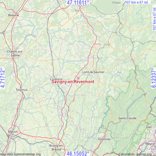
Savigny-en-Revermont GPS coordinates[2]
46° 38' 7.692" North, 5° 25' 12.864" East
| Map corner | latitude | longitude |
|---|---|---|
| Upper-left | 47.11611°, | 4.71712° |
| Center: | 46.63547°, | 5.42024° |
| Lower-right: | 46.15052°, | 6.12337° |
| Map W x H: | 107.4×107.4 km | = 66.7×66.7mi |
| max Lat: | 51.07786° ⇑58.9% North |
| Savigny-en-Revermont: | 46.63547° |
| min Lat: | ⇓41.1% South 41.3874° |
| min Long | Savigny-en-Reve | max Long |
| -5.08615° | 5.42024° | 9.52242° |
| W 82.2%⇐ | ⇒17.8% E |
Elevation
Elevation of Savigny-en-Revermont is 217 m = 712 ft, and this is 23.3 m = 76 ft above average elevation for this country.
| Max E: |
2333 m = 7654 ft | 30.4% |
| Savigny-en-Revermont | 217 m 712 ft | |
| Avg. | 193.7 m = 635 ft | |
Min E: |
-1 m = -3 ft | 69.6% |
See also: France elevation on elevation.city.
Geographical zone
Savigny-en-Revermont is located in North temperate zone (between Tropic of Cancer and the Arctic Circle). Distance of this North polar circle is 2215.8 km =1376.8 mi to North.| Distance of | km | miles | from Savigny-en-Revermont |
|---|---|---|---|
| North Pole | 4821.7 | 2996.1 | to North |
| Arctic Circle | 2215.8 | 1376.8 | to North |
| Tropic Cancer | 2579.5 | 1602.8 | to South |
| Equator | 5185.4 | 3222.1 | to South |


Nearby cities:
15 places around Savigny-en-Revermont: (largest is in red/bold)
• Beaufort
7 km =4.3 mi,  168°
168°
• Beaurepaire-en-Bresse
4.4 km =2.7 mi,  326°
326°
• Courbouzon
8.4 km =5.2 mi,  78°
78°
• Courlans
7.2 km =4.5 mi,  52°
52°
• Courlaoux
4.9 km =3 mi,  38°
38°
• Gevingey
6.5 km =4 mi,  88°
88°
• Larnaud
8.8 km =5.5 mi,  17°
17°
• Le Fay
7.8 km =4.8 mi,  297°
297°
• Lons-le-Saunier
11.3 km =7 mi,  66°
66°
• Macornay
9.4 km =5.8 mi, 82°
• Messia-sur-Sorne
7.6 km =4.7 mi, 67°
• Montaigu
11.5 km =7.1 mi, 76°
• Montmorot
9 km =5.6 mi,  60°
60°
• Sagy
9.2 km =5.7 mi,  245°
245°
• Saillenard
7.2 km =4.5 mi, 328°
Sources, notices
• [Note1] Compared only with cities in France existing in our database
• [Src1] Map data: © OpenStreetMap contributors (CC-BY-SA)
• [Src2] Other city data from geonames.org with taken over terms of usage.
• [Src3] Geographical zone / Annual Mean Temperature by Robert A. Rohde @ Wikipedia
