Lons-le-Saunier geodata
Lons-le-Saunier (Bourgogne-Franche-Comté) is a seat of a second-order administrative division; located in France in Europe/Paris (GMT+2) time zone. With population of 20,678 people, there are 442 cities with bigger population in this country. Compared to other cities in France, 58.5% of cities are located further ↑North; 83.4% of cities are located further ←West and 78.4% of cities have lower elevation than Lons-le-Saunier. Note1
Administrative division(s):
- Level 1: Bourgogne-Franche-Comté
- Level 2: Jura
- Level 3: Arrondissement de Lons-le-Saunier
- Level 4: Lons-le-Saunier


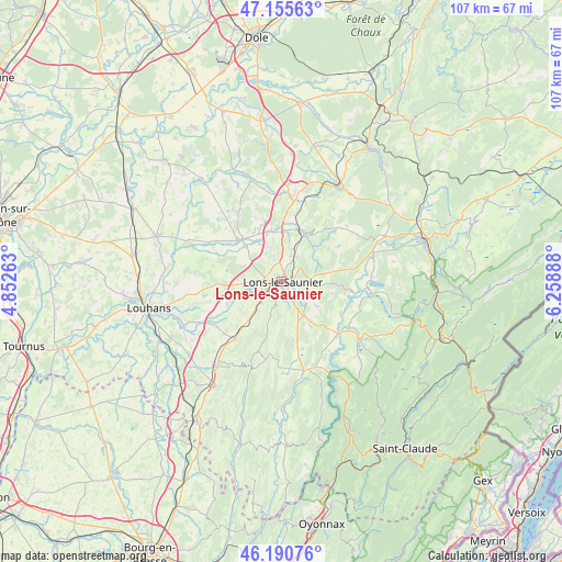
Lons-le-Saunier GPS coordinates[2]
46° 40' 31.26" North, 5° 33' 20.7" East
| Map corner | latitude | longitude |
|---|---|---|
| Upper-left | 47.15563°, | 4.85263° |
| Center: | 46.67535°, | 5.55575° |
| Lower-right: | 46.19076°, | 6.25888° |
| Map W x H: | 107.3×107.3 km | = 66.7×66.7mi |
| max Lat: | 51.07786° ⇑58.5% North |
| Lons-le-Saunier: | 46.67535° |
| min Lat: | ⇓41.5% South 41.3874° |
| min Long | Lons-le-Saunier | max Long |
| -5.08615° | 5.55575° | 9.52242° |
| W 83.4%⇐ | ⇒16.6% E |
Elevation
Elevation of Lons-le-Saunier is 275 m = 902 ft, and this is 81.3 m = 267 ft above average elevation for this country.
| Max E: |
2333 m = 7654 ft | 21.6% |
| Lons-le-Saunier | 275 m 902 ft | |
| Avg. | 193.7 m = 635 ft | |
Min E: |
-1 m = -3 ft | 78.4% |
See also: France elevation on elevation.city.
Geographical zone
Lons-le-Saunier is located in North temperate zone (between Tropic of Cancer and the Arctic Circle). Distance of this North polar circle is 2211.4 km =1374.1 mi to North.| Distance of | km | miles | from Lons-le-Saunier |
|---|---|---|---|
| North Pole | 4817.2 | 2993.3 | to North |
| Arctic Circle | 2211.4 | 1374.1 | to North |
| Tropic Cancer | 2583.9 | 1605.6 | to South |
| Equator | 5189.8 | 3224.8 | to South |


Nearby cities:
15 places around Lons-le-Saunier: (largest is in red/bold)
• Conliège
4 km =2.5 mi,  124°
124°
• Courbouzon
3.5 km =2.2 mi,  218°
218°
• Courlans
4.6 km =2.9 mi,  269°
269°
• Courlaoux
7.3 km =4.5 mi, 265°
• Crançot
8 km =5 mi,  81°
81°
• Gevingey
5.8 km =3.6 mi, 221°
• Larnaud
8.7 km =5.4 mi,  297°
297°
• Macornay
3.4 km =2.1 mi,  197°
197°
• Messia-sur-Sorne
3.7 km =2.3 mi,  245°
245°
• Montaigu
2 km =1.2 mi,  154°
154°
• Montmorot
2.5 km =1.6 mi, 270°
• Perrigny
2.4 km =1.5 mi,  111°
111°
• Plainoiseau
6.4 km =4 mi,  0°
0°
• Ruffey-sur-Seille
8.9 km =5.5 mi,  328°
328°
• Saint-Germain-lès-Arlay
9.4 km =5.8 mi, 2°
Sources, notices
• [Note1] Compared only with cities in France existing in our database
• [Src1] Map data: © OpenStreetMap contributors (CC-BY-SA)
• [Src2] Other city data from geonames.org with taken over terms of usage.
• [Src3] Geographical zone / Annual Mean Temperature by Robert A. Rohde @ Wikipedia
