Santec geodata
Santec (Brittany) is a populated place; located in France in Europe/Paris (GMT+2) time zone. With population of 2,272 people, there are 4238 cities with bigger population in this country. Compared to other cities in France, 73.2% of cities are located further ↓South; 99.1% of cities are located further →East and 93.6% of cities have higher elevation than Santec. Note1
Administrative division(s):
- Level 1: Brittany
- Level 2: Département du Finistère
- Level 3: Arrondissement de Morlaix
- Level 4: Santec


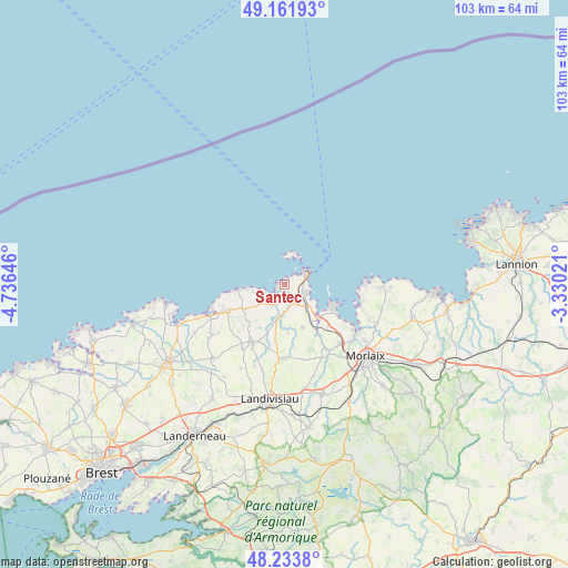
Santec GPS coordinates[2]
48° 42' 0" North, 4° 1' 59.988" West
| Map corner | latitude | longitude |
|---|---|---|
| Upper-left | 49.16193°, | -4.73646° |
| Center: | 48.7°, | -4.03333° |
| Lower-right: | 48.2338°, | -3.33021° |
| Map W x H: | 103.2×103.2 km | = 64.1×64.1mi |
| max Lat: | 51.07786° ⇑26.8% North |
| Santec: | 48.7° |
| min Lat: | ⇓73.2% South 41.3874° |
| min Long | Santec | max Long |
| -5.08615° | -4.03333° | 9.52242° |
| W 0.9%⇐ | ⇒99.1% E |
Elevation
Elevation of Santec is 21 m = 69 ft, and this is 172.7 m = 567 ft below average elevation for this country.
| Max E: |
2333 m = 7654 ft | 93.6% |
| Avg. | 193.7 m = 635 ft | |
| Santec | 21 m = 69 ft | |
Min E: |
-1 m = -3 ft | 6.4% |
See also: France elevation on elevation.city.
Geographical zone
Santec is located in North temperate zone (between Tropic of Cancer and the Arctic Circle). Distance of this North polar circle is 1986.2 km =1234.2 mi to North.| Distance of | km | miles | from Santec |
|---|---|---|---|
| North Pole | 4592.1 | 2853.4 | to North |
| Arctic Circle | 1986.2 | 1234.2 | to North |
| Tropic Cancer | 2809 | 1745.4 | to South |
| Equator | 5414.9 | 3364.7 | to South |


Nearby cities:
15 places around Santec: (largest is in red/bold)
• Carantec
9.4 km =5.8 mi,  112°
112°
• Cléder
6.5 km =4 mi,  230°
230°
• Henvic
10.9 km =6.8 mi,  133°
133°
• Mespaul
9 km =5.6 mi,  176°
176°
• Plouescat
10.5 km =6.5 mi,  249°
249°
• Plougoulm
3.9 km =2.4 mi,  198°
198°
• Plouvorn
13 km =8.1 mi, 180°
• Plouzévédé
12.7 km =7.9 mi,  208°
208°
• Plouénan
7.8 km =4.8 mi,  161°
161°
• Roscoff
4.3 km =2.7 mi,  52°
52°
• Saint-Pol-de-Léon
4.1 km =2.5 mi,  116°
116°
• Saint-Vougay
13.3 km =8.3 mi, 213°
• Sibiril
4.4 km =2.7 mi, 213°
• Taulé
14.8 km =9.2 mi,  138°
138°
• Île-de-Batz
5.7 km =3.5 mi,  12°
12°
Sources, notices
• [Note1] Compared only with cities in France existing in our database
• [Src1] Map data: © OpenStreetMap contributors (CC-BY-SA)
• [Src2] Other city data from geonames.org with taken over terms of usage.
• [Src3] Geographical zone / Annual Mean Temperature by Robert A. Rohde @ Wikipedia
