Roscoff geodata
Roscoff (Brittany) is a populated place; located in France in Europe/Paris (GMT+2) time zone. With population of 3,772 people, there are 2600 cities with bigger population in this country. Compared to other cities in France, 73.8% of cities are located further ↓South; 99% of cities are located further →East and 98.2% of cities have higher elevation than Roscoff. Note1
Administrative division(s):
- Level 1: Brittany
- Level 2: Département du Finistère
- Level 3: Arrondissement de Morlaix
- Level 4: Roscoff


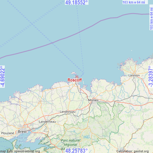
Roscoff GPS coordinates[2]
48° 43' 25.716" North, 3° 59' 13.524" West
| Map corner | latitude | longitude |
|---|---|---|
| Upper-left | 49.18552°, | -4.69022° |
| Center: | 48.72381°, | -3.98709° |
| Lower-right: | 48.25783°, | -3.28397° |
| Map W x H: | 103.1×103.1 km | = 64.1×64.1mi |
| max Lat: | 51.07786° ⇑26.2% North |
| Roscoff: | 48.72381° |
| min Lat: | ⇓73.8% South 41.3874° |
| min Long | Roscoff | max Long |
| -5.08615° | -3.98709° | 9.52242° |
| W 1%⇐ | ⇒99% E |
Elevation
Elevation of Roscoff is 8 m = 26 ft, and this is 185.7 m = 609 ft below average elevation for this country.
| Max E: |
2333 m = 7654 ft | 98.2% |
| Avg. | 193.7 m = 635 ft | |
| Roscoff | 8 m = 26 ft | |
Min E: |
-1 m = -3 ft | 1.8% |
See also: France elevation on elevation.city.
Geographical zone
Roscoff is located in North temperate zone (between Tropic of Cancer and the Arctic Circle). Distance of this North polar circle is 1983.6 km =1232.6 mi to North.| Distance of | km | miles | from Roscoff |
|---|---|---|---|
| North Pole | 4589.5 | 2851.8 | to North |
| Arctic Circle | 1983.6 | 1232.6 | to North |
| Tropic Cancer | 2811.7 | 1747.1 | to South |
| Equator | 5417.6 | 3366.3 | to South |


Nearby cities:
15 places around Roscoff: (largest is in red/bold)
• Carantec
8.1 km =5 mi,  139°
139°
• Cléder
10.8 km =6.7 mi,  231°
231°
• Henvic
11.1 km =6.9 mi,  156°
156°
• Locquénolé
14.3 km =8.9 mi, 139°
• Mespaul
12 km =7.5 mi,  193°
193°
• Plouescat
14.6 km =9.1 mi,  244°
244°
• Plougasnou
14 km =8.7 mi,  100°
100°
• Plougoulm
7.9 km =4.9 mi,  216°
216°
• Plouvorn
16 km =9.9 mi, 192°
• Plouénan
10.1 km =6.3 mi, 185°
• Saint-Pol-de-Léon
4.5 km =2.8 mi,  176°
176°
• Santec
4.3 km =2.7 mi, 232°
• Sibiril
8.6 km =5.3 mi, 222°
• Taulé
15.2 km =9.4 mi, 155°
• Île-de-Batz
3.6 km =2.2 mi,  323°
323°
Sources, notices
• [Note1] Compared only with cities in France existing in our database
• [Src1] Map data: © OpenStreetMap contributors (CC-BY-SA)
• [Src2] Other city data from geonames.org with taken over terms of usage.
• [Src3] Geographical zone / Annual Mean Temperature by Robert A. Rohde @ Wikipedia
