Saint-Pierre-de-Rivière geodata
Saint-Pierre-de-Rivière (Occitanie) is a populated place; located in France in Europe/Paris (GMT+2) time zone. With population of 603 people, there are 13268 cities with bigger population in this country. Compared to other cities in France, 98.5% of cities are located further ↑North; 62.3% of cities are located further →East and 92.1% of cities have lower elevation than Saint-Pierre-de-Rivière. Note1
Administrative division(s):
- Level 1: Occitanie
- Level 2: Département de l'Ariège
- Level 3: Arrondissement de Foix
- Level 4: Saint-Pierre-de-Rivière
Current local time in Saint-Pierre-de-Rivière:
03:19 PM, SundayDifference from your time zone: hours


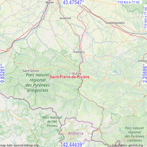
Saint-Pierre-de-Rivière GPS coordinates[2]
42° 57' 47.088" North, 1° 33' 20.628" East
| Map corner | latitude | longitude |
|---|---|---|
| Upper-left | 43.47547°, | 0.85261° |
| Center: | 42.96308°, | 1.55573° |
| Lower-right: | 42.44639°, | 2.25886° |
| Map W x H: | 114.4×114.4 km | = 71.1×71.1mi |
| max Lat: | 51.07786° ⇑98.5% North |
| Saint-Pierre-de-Rivière: | 42.96308° |
| min Lat: | ⇓1.5% South 41.3874° |
| min Long | Saint-Pierre-de | max Long |
| -5.08615° | 1.55573° | 9.52242° |
| W 37.7%⇐ | ⇒62.3% E |
Elevation
Elevation of Saint-Pierre-de-Rivière is 479 m = 1572 ft, and this is 285.3 m = 936 ft above average elevation for this country.
| Max E: |
2333 m = 7654 ft | 7.9% |
| Saint-Pierre-de-Rivière | 479 m 1572 ft | |
| Avg. | 193.7 m = 635 ft | |
Min E: |
-1 m = -3 ft | 92.1% |
See also: France elevation on elevation.city.
Geographical zone
Saint-Pierre-de-Rivière is located in North temperate zone (between Tropic of Cancer and the Arctic Circle). Distance of this Northern Tropic circle is 2171.1 km =1349.1 mi to South.| Distance of | km | miles | from Saint-Pierre-de-Rivière |
|---|---|---|---|
| North Pole | 5230 | 3249.8 | to North |
| Arctic Circle | 2624.1 | 1630.5 | to North |
| Tropic Cancer | 2171.1 | 1349.1 | to South |
| Equator | 4777 | 2968.3 | to South |


Nearby cities:
15 places around Saint-Pierre-de-Rivière: (largest is in red/bold)
• Arignac
11 km =6.8 mi,  161°
161°
• Brassac
2.5 km =1.6 mi,  217°
217°
• Crampagna
8.5 km =5.3 mi,  26°
26°
• Dalou
10.5 km =6.5 mi,  41°
41°
• Ferrières-sur-Ariège
5.4 km =3.4 mi,  118°
118°
• Foix
4.3 km =2.7 mi,  93°
93°
• Ganac
2 km =1.2 mi, 161°
• Mercus-Garrabet
11.2 km =7 mi,  147°
147°
• Montgaillard
7.1 km =4.4 mi, 117°
• Saint-Jean-de-Verges
7.2 km =4.5 mi, 38°
• Saint-Paul-de-Jarrat
9.7 km =6 mi, 124°
• Saurat
9.5 km =5.9 mi,  188°
188°
• Serres-sur-Arget
3.3 km =2.1 mi,  281°
281°
• Varilhes
10.9 km =6.8 mi, 32°
• Vernajoul
4.8 km =3 mi,  58°
58°
Sources, notices
• [Note1] Compared only with cities in France existing in our database
• [Src1] Map data: © OpenStreetMap contributors (CC-BY-SA)
• [Src2] Other city data from geonames.org with taken over terms of usage.
• [Src3] Geographical zone / Annual Mean Temperature by Robert A. Rohde @ Wikipedia
