Saint-Christophe-sur-Dolaison geodata
Saint-Christophe-sur-Dolaison (Auvergne-Rhône-Alpes) is a populated place; located in France in Europe/Paris (GMT+2) time zone. With population of 956 people, there are 9159 cities with bigger population in this country. Compared to other cities in France, 79.7% of cities are located further ↑North; 66.4% of cities are located further ←West and 98.7% of cities have lower elevation than Saint-Christophe-sur-Dolaison. Note1
Administrative division(s):
- Level 1: Auvergne-Rhône-Alpes
- Level 2: Haute-Loire
- Level 3: Arrondissement du Puy-en-Velay
- Level 4: Saint-Christophe-sur-Dolaison
Current local time in Saint-Christophe-sur-Dolaison:
09:58 AM, SaturdayDifference from your time zone: hours


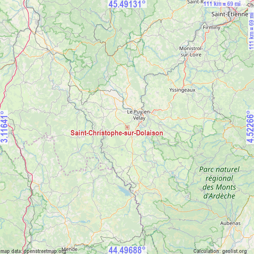
Saint-Christophe-sur-Dolaison GPS coordinates[2]
44° 59' 46.5" North, 3° 49' 10.344" East
| Map corner | latitude | longitude |
|---|---|---|
| Upper-left | 45.49131°, | 3.11641° |
| Center: | 44.99625°, | 3.81954° |
| Lower-right: | 44.49688°, | 4.52266° |
| Map W x H: | 110.6×110.6 km | = 68.7×68.7mi |
| max Lat: | 51.07786° ⇑79.7% North |
| Saint-Christophe-sur-Dolaison: | 44.99625° |
| min Lat: | ⇓20.3% South 41.3874° |
| min Long | Saint-Christoph | max Long |
| -5.08615° | 3.81954° | 9.52242° |
| W 66.4%⇐ | ⇒33.6% E |
Elevation
Elevation of Saint-Christophe-sur-Dolaison is 912 m = 2992 ft, and this is 718.3 m = 2357 ft above average elevation for this country.
| Max E: |
2333 m = 7654 ft | 1.3% |
| Saint-Christophe-sur-Dolaison | 912 m 2992 ft | |
| Avg. | 193.7 m = 635 ft | |
Min E: |
-1 m = -3 ft | 98.7% |
See also: France elevation on elevation.city.
Geographical zone
Saint-Christophe-sur-Dolaison is located in North temperate zone (between Tropic of Cancer and the Arctic Circle). Distance of this Northern Tropic circle is 2397.2 km =1489.6 mi to South.| Distance of | km | miles | from Saint-Christophe-sur-Dolaison |
|---|---|---|---|
| North Pole | 5003.9 | 3109.3 | to North |
| Arctic Circle | 2398.1 | 1490.1 | to North |
| Tropic Cancer | 2397.2 | 1489.6 | to South |
| Equator | 5003.1 | 3108.8 | to South |


Nearby cities:
15 places around Saint-Christophe-sur-Dolaison: (largest is in red/bold)
• Arsac-en-Velay
9.8 km =6.1 mi,  93°
93°
• Bains
3.8 km =2.4 mi,  292°
292°
• Brives-Charensac
10.3 km =6.4 mi,  56°
56°
• Cayres
7.9 km =4.9 mi,  187°
187°
• Chadrac
9.8 km =6.1 mi,  41°
41°
• Chaspuzac
9.7 km =6 mi,  325°
325°
• Costaros
11.5 km =7.1 mi,  167°
167°
• Coubon
7.7 km =4.8 mi, 89°
• Cussac-sur-Loire
5.2 km =3.2 mi,  100°
100°
• Espaly-Saint-Marcel
6.8 km =4.2 mi,  32°
32°
• Le Brignon
8.3 km =5.2 mi,  144°
144°
• Le Puy-en-Velay
7.4 km =4.6 mi, 44°
• Polignac
8.9 km =5.5 mi,  21°
21°
• Solignac-sur-Loire
6.1 km =3.8 mi,  120°
120°
• Vals-près-le-Puy
6 km =3.7 mi,  49°
49°
Sources, notices
• [Note1] Compared only with cities in France existing in our database
• [Src1] Map data: © OpenStreetMap contributors (CC-BY-SA)
• [Src2] Other city data from geonames.org with taken over terms of usage.
• [Src3] Geographical zone / Annual Mean Temperature by Robert A. Rohde @ Wikipedia
