Espaly-Saint-Marcel geodata
Espaly-Saint-Marcel (Auvergne-Rhône-Alpes) is a populated place; located in France in Europe/Paris (GMT+2) time zone. With population of 3,971 people, there are 2479 cities with bigger population in this country. Compared to other cities in France, 79.1% of cities are located further ↑North; 66.7% of cities are located further ←West and 95.9% of cities have lower elevation than Espaly-Saint-Marcel. Note1
Administrative division(s):
- Level 1: Auvergne-Rhône-Alpes
- Level 2: Haute-Loire
- Level 3: Arrondissement du Puy-en-Velay
- Level 4: Espaly-Saint-Marcel


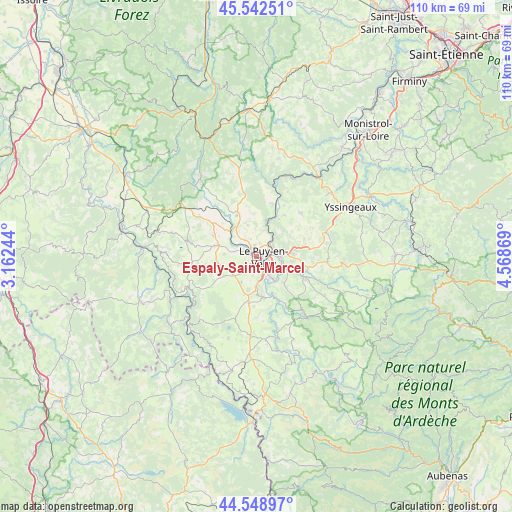
Espaly-Saint-Marcel GPS coordinates[2]
45° 2' 52.44" North, 3° 51' 56.052" East
| Map corner | latitude | longitude |
|---|---|---|
| Upper-left | 45.54251°, | 3.16244° |
| Center: | 45.0479°, | 3.86557° |
| Lower-right: | 44.54897°, | 4.56869° |
| Map W x H: | 110.5×110.5 km | = 68.7×68.7mi |
| max Lat: | 51.07786° ⇑79.1% North |
| Espaly-Saint-Marcel: | 45.0479° |
| min Lat: | ⇓20.9% South 41.3874° |
| min Long | Espaly-Saint-Ma | max Long |
| -5.08615° | 3.86557° | 9.52242° |
| W 66.7%⇐ | ⇒33.3% E |
Elevation
Elevation of Espaly-Saint-Marcel is 639 m = 2096 ft, and this is 445.3 m = 1461 ft above average elevation for this country.
| Max E: |
2333 m = 7654 ft | 4.1% |
| Espaly-Saint-Marcel | 639 m 2096 ft | |
| Avg. | 193.7 m = 635 ft | |
Min E: |
-1 m = -3 ft | 95.9% |
See also: France elevation on elevation.city.
Geographical zone
Espaly-Saint-Marcel is located in North temperate zone (between Tropic of Cancer and the Arctic Circle). Distance of this North polar circle is 2392.3 km =1486.5 mi to North.| Distance of | km | miles | from Espaly-Saint-Marcel |
|---|---|---|---|
| North Pole | 4998.2 | 3105.7 | to North |
| Arctic Circle | 2392.3 | 1486.5 | to North |
| Tropic Cancer | 2402.9 | 1493.1 | to South |
| Equator | 5008.9 | 3112.4 | to South |


Nearby cities:
15 places around Espaly-Saint-Marcel: (largest is in red/bold)
• Arsac-en-Velay
8.8 km =5.5 mi,  136°
136°
• Bains
8.3 km =5.2 mi,  239°
239°
• Blavozy
9 km =5.6 mi,  83°
83°
• Brives-Charensac
5 km =3.1 mi,  90°
90°
• Chadrac
3.3 km =2.1 mi,  62°
62°
• Chaspinhac
7.5 km =4.7 mi, 55°
• Coubon
7 km =4.3 mi, 143°
• Cussac-sur-Loire
6.8 km =4.2 mi,  167°
167°
• Lavoûte-sur-Loire
8.4 km =5.2 mi,  21°
21°
• Le Puy-en-Velay
1.6 km =1 mi,  106°
106°
• Polignac
2.6 km =1.6 mi,  350°
350°
• Saint-Christophe-sur-Dolaison
6.8 km =4.2 mi,  212°
212°
• Saint-Germain-Laprade
8.3 km =5.2 mi,  97°
97°
• Solignac-sur-Loire
9 km =5.6 mi, 169°
• Vals-près-le-Puy
2.1 km =1.3 mi,  152°
152°
Sources, notices
• [Note1] Compared only with cities in France existing in our database
• [Src1] Map data: © OpenStreetMap contributors (CC-BY-SA)
• [Src2] Other city data from geonames.org with taken over terms of usage.
• [Src3] Geographical zone / Annual Mean Temperature by Robert A. Rohde @ Wikipedia
