Rahling geodata
Rahling (Grand Est) is a populated place; located in France in Europe/Paris (GMT+2) time zone. With population of 812 people, there are 10458 cities with bigger population in this country. Compared to other cities in France, 79.5% of cities are located further ↓South; 95.9% of cities are located further ←West and 74% of cities have lower elevation than Rahling. Note1
Administrative division(s):
- Level 1: Grand Est
- Level 2: Moselle
- Level 3: Arrondissement de Sarreguemines
- Level 4: Rahling


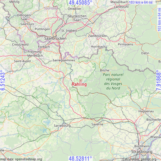
Rahling GPS coordinates[2]
48° 59' 29.832" North, 7° 12' 56.016" East
| Map corner | latitude | longitude |
|---|---|---|
| Upper-left | 49.45085°, | 6.51243° |
| Center: | 48.99162°, | 7.21556° |
| Lower-right: | 48.52811°, | 7.91868° |
| Map W x H: | 102.6×102.6 km | = 63.8×63.8mi |
| max Lat: | 51.07786° ⇑20.5% North |
| Rahling: | 48.99162° |
| min Lat: | ⇓79.5% South 41.3874° |
| min Long | Rahling | max Long |
| -5.08615° | 7.21556° | 9.52242° |
| W 95.9%⇐ | ⇒4.1% E |
Elevation
Elevation of Rahling is 242 m = 794 ft, and this is 48.3 m = 158 ft above average elevation for this country.
| Max E: |
2333 m = 7654 ft | 26% |
| Rahling | 242 m 794 ft | |
| Avg. | 193.7 m = 635 ft | |
Min E: |
-1 m = -3 ft | 74% |
See also: France elevation on elevation.city.
Geographical zone
Rahling is located in North temperate zone (between Tropic of Cancer and the Arctic Circle). Distance of this North polar circle is 1953.8 km =1214 mi to North.| Distance of | km | miles | from Rahling |
|---|---|---|---|
| North Pole | 4559.7 | 2833.3 | to North |
| Arctic Circle | 1953.8 | 1214 | to North |
| Tropic Cancer | 2841.4 | 1765.6 | to South |
| Equator | 5447.4 | 3384.9 | to South |


Nearby cities:
15 places around Rahling: (largest is in red/bold)
• Achen
6.4 km =4 mi,  337°
337°
• Bining
5.8 km =3.6 mi,  28°
28°
• Butten
2.4 km =1.5 mi,  167°
167°
• Diemeringen
6.1 km =3.8 mi,  199°
199°
• Enchenberg
9.3 km =5.8 mi,  74°
74°
• Etting
5.2 km =3.2 mi,  328°
328°
• Gros-Réderching
8.5 km =5.3 mi,  1°
1°
• Kalhausen
5.7 km =3.5 mi,  307°
307°
• Mackwiller
7.9 km =4.9 mi, 201°
• Montbronn
6.9 km =4.3 mi,  89°
89°
• Oermingen
6.4 km =4 mi,  278°
278°
• Rohrbach-lès-Bitche
7 km =4.3 mi, 32°
• Waldhambach
7.2 km =4.5 mi,  179°
179°
• Weislingen
8.4 km =5.2 mi,  160°
160°
• Wittring
8.7 km =5.4 mi,  322°
322°
Sources, notices
• [Note1] Compared only with cities in France existing in our database
• [Src1] Map data: © OpenStreetMap contributors (CC-BY-SA)
• [Src2] Other city data from geonames.org with taken over terms of usage.
• [Src3] Geographical zone / Annual Mean Temperature by Robert A. Rohde @ Wikipedia
