Kalhausen geodata
Kalhausen (Grand Est) is a populated place; located in France in Europe/Paris (GMT+2) time zone. With population of 863 people, there are 9962 cities with bigger population in this country. Compared to other cities in France, 80.2% of cities are located further ↓South; 95.5% of cities are located further ←West and 81.7% of cities have lower elevation than Kalhausen. Note1
Administrative division(s):
- Level 1: Grand Est
- Level 2: Moselle
- Level 3: Arrondissement de Sarreguemines
- Level 4: Kalhausen


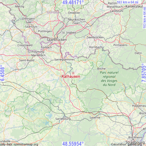
Kalhausen GPS coordinates[2]
49° 1' 21.936" North, 7° 9' 14.112" East
| Map corner | latitude | longitude |
|---|---|---|
| Upper-left | 49.48171°, | 6.4508° |
| Center: | 49.02276°, | 7.15392° |
| Lower-right: | 48.55954°, | 7.85705° |
| Map W x H: | 102.5×102.5 km | = 63.7×63.7mi |
| max Lat: | 51.07786° ⇑19.8% North |
| Kalhausen: | 49.02276° |
| min Lat: | ⇓80.2% South 41.3874° |
| min Long | Kalhausen | max Long |
| -5.08615° | 7.15392° | 9.52242° |
| W 95.5%⇐ | ⇒4.5% E |
Elevation
Elevation of Kalhausen is 308 m = 1010 ft, and this is 114.3 m = 375 ft above average elevation for this country.
| Max E: |
2333 m = 7654 ft | 18.3% |
| Kalhausen | 308 m 1010 ft | |
| Avg. | 193.7 m = 635 ft | |
Min E: |
-1 m = -3 ft | 81.7% |
See also: France elevation on elevation.city.
Geographical zone
Kalhausen is located in North temperate zone (between Tropic of Cancer and the Arctic Circle). Distance of this North polar circle is 1950.4 km =1211.9 mi to North.| Distance of | km | miles | from Kalhausen |
|---|---|---|---|
| North Pole | 4556.2 | 2831.1 | to North |
| Arctic Circle | 1950.4 | 1211.9 | to North |
| Tropic Cancer | 2844.9 | 1767.7 | to South |
| Equator | 5450.8 | 3387 | to South |


Nearby cities:
15 places around Kalhausen: (largest is in red/bold)
• Achen
3.2 km =2 mi,  39°
39°
• Bining
7.4 km =4.6 mi,  77°
77°
• Butten
7.7 km =4.8 mi,  139°
139°
• Etting
2 km =1.2 mi,  62°
62°
• Gros-Réderching
6.9 km =4.3 mi, 43°
• Herbitzheim
5.3 km =3.3 mi,  261°
261°
• Oermingen
3.1 km =1.9 mi,  216°
216°
• Rahling
5.7 km =3.5 mi,  127°
127°
• Rohrbach-lès-Bitche
8.6 km =5.3 mi,  73°
73°
• Sarreinsming
8.2 km =5.1 mi,  337°
337°
• Siltzheim
6.4 km =4 mi,  315°
315°
• Wiesviller
6.5 km =4 mi,  6°
6°
• Willerwald
8.5 km =5.3 mi,  271°
271°
• Wittring
3.5 km =2.2 mi,  346°
346°
• Wœlfling-lès-Sarreguemines
7.1 km =4.4 mi,  17°
17°
Sources, notices
• [Note1] Compared only with cities in France existing in our database
• [Src1] Map data: © OpenStreetMap contributors (CC-BY-SA)
• [Src2] Other city data from geonames.org with taken over terms of usage.
• [Src3] Geographical zone / Annual Mean Temperature by Robert A. Rohde @ Wikipedia
