Plancoët geodata
Plancoët (Brittany) is a populated place; located in France in Europe/Paris (GMT+2) time zone. With population of 2,703 people, there are 3614 cities with bigger population in this country. Compared to other cities in France, 68.9% of cities are located further ↓South; 95.6% of cities are located further →East and 93.6% of cities have higher elevation than Plancoët. Note1
Administrative division(s):
- Level 1: Brittany
- Level 2: Département des Côtes-d’Armor
- Level 3: Arrondissement de Dinan
- Level 4: Plancoët


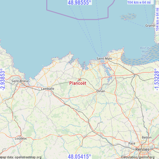
Plancoët GPS coordinates[2]
48° 31' 19.164" North, 2° 14' 7.44" West
| Map corner | latitude | longitude |
|---|---|---|
| Upper-left | 48.98555°, | -2.93853° |
| Center: | 48.52199°, | -2.2354° |
| Lower-right: | 48.05415°, | -1.53228° |
| Map W x H: | 103.6×103.6 km | = 64.4×64.4mi |
| max Lat: | 51.07786° ⇑31.1% North |
| Plancoët: | 48.52199° |
| min Lat: | ⇓68.9% South 41.3874° |
| min Long | Plancoët | max Long |
| -5.08615° | -2.2354° | 9.52242° |
| W 4.4%⇐ | ⇒95.6% E |
Elevation
Elevation of Plancoët is 21 m = 69 ft, and this is 172.7 m = 567 ft below average elevation for this country.
| Max E: |
2333 m = 7654 ft | 93.6% |
| Avg. | 193.7 m = 635 ft | |
| Plancoët | 21 m = 69 ft | |
Min E: |
-1 m = -3 ft | 6.4% |
See also: France elevation on elevation.city.
Geographical zone
Plancoët is located in North temperate zone (between Tropic of Cancer and the Arctic Circle). Distance of this North polar circle is 2006 km =1246.5 mi to North.| Distance of | km | miles | from Plancoët |
|---|---|---|---|
| North Pole | 4611.9 | 2865.7 | to North |
| Arctic Circle | 2006 | 1246.5 | to North |
| Tropic Cancer | 2789.2 | 1733.1 | to South |
| Equator | 5395.1 | 3352.4 | to South |


Nearby cities:
15 places around Plancoët: (largest is in red/bold)
• Aucaleuc
10.7 km =6.6 mi,  134°
134°
• Bourseul
4.2 km =2.6 mi,  204°
204°
• Corseul
6.6 km =4.1 mi, 132°
• Créhen
3.1 km =1.9 mi,  32°
32°
• Languenan
8.1 km =5 mi,  98°
98°
• Matignon
9.2 km =5.7 mi,  333°
333°
• Ploubalay
9.6 km =6 mi,  46°
46°
• Pluduno
2.6 km =1.6 mi,  292°
292°
• Plélan-le-Petit
10.1 km =6.3 mi,  172°
172°
• Pléven
7.1 km =4.4 mi,  239°
239°
• Ruca
9.1 km =5.7 mi,  303°
303°
• Saint-Jacut-de-la-Mer
9.1 km =5.7 mi,  22°
22°
• Saint-Lormel
2.8 km =1.7 mi,  7°
7°
• Saint-Pôtan
4.7 km =2.9 mi,  311°
311°
• Vildé-Guingalan
11 km =6.8 mi,  148°
148°
Sources, notices
• [Note1] Compared only with cities in France existing in our database
• [Src1] Map data: © OpenStreetMap contributors (CC-BY-SA)
• [Src2] Other city data from geonames.org with taken over terms of usage.
• [Src3] Geographical zone / Annual Mean Temperature by Robert A. Rohde @ Wikipedia
