Saint-Pôtan geodata
Saint-Pôtan (Brittany) is a populated place; located in France in Europe/Paris (GMT+2) time zone. With population of 765 people, there are 11005 cities with bigger population in this country. Compared to other cities in France, 69.5% of cities are located further ↓South; 95.7% of cities are located further →East and 86.2% of cities have higher elevation than Saint-Pôtan. Note1
Administrative division(s):
- Level 1: Brittany
- Level 2: Département des Côtes-d’Armor
- Level 3: Arrondissement de Dinan
- Level 4: Saint-Pôtan


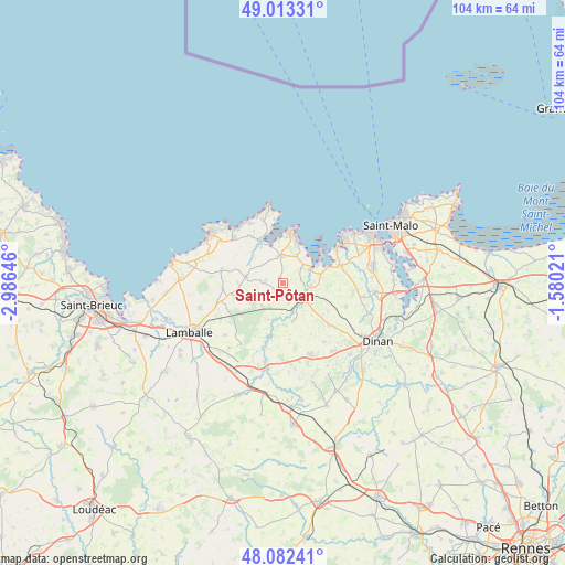
Saint-Pôtan GPS coordinates[2]
48° 33' 0" North, 2° 16' 59.988" West
| Map corner | latitude | longitude |
|---|---|---|
| Upper-left | 49.01331°, | -2.98646° |
| Center: | 48.55°, | -2.28333° |
| Lower-right: | 48.08241°, | -1.58021° |
| Map W x H: | 103.5×103.5 km | = 64.3×64.3mi |
| max Lat: | 51.07786° ⇑30.5% North |
| Saint-Pôtan: | 48.55° |
| min Lat: | ⇓69.5% South 41.3874° |
| min Long | Saint-Pôtan | max Long |
| -5.08615° | -2.28333° | 9.52242° |
| W 4.3%⇐ | ⇒95.7% E |
Elevation
Elevation of Saint-Pôtan is 39 m = 128 ft, and this is 154.7 m = 508 ft below average elevation for this country.
| Max E: |
2333 m = 7654 ft | 86.2% |
| Avg. | 193.7 m = 635 ft | |
| Saint-Pôtan | 39 m = 128 ft | |
Min E: |
-1 m = -3 ft | 13.8% |
See also: France elevation on elevation.city.
Geographical zone
Saint-Pôtan is located in North temperate zone (between Tropic of Cancer and the Arctic Circle). Distance of this North polar circle is 2002.9 km =1244.5 mi to North.| Distance of | km | miles | from Saint-Pôtan |
|---|---|---|---|
| North Pole | 4608.8 | 2863.8 | to North |
| Arctic Circle | 2002.9 | 1244.5 | to North |
| Tropic Cancer | 2792.3 | 1735.1 | to South |
| Equator | 5398.3 | 3354.3 | to South |


Nearby cities:
15 places around Saint-Pôtan: (largest is in red/bold)
• Bourseul
7.2 km =4.5 mi,  165°
165°
• Créhen
5.2 km =3.2 mi,  95°
95°
• Fréhel
11.1 km =6.9 mi,  326°
326°
• Hénanbihen
6.9 km =4.3 mi,  279°
279°
• Hénansal
11.1 km =6.9 mi,  264°
264°
• Matignon
5.2 km =3.2 mi,  353°
353°
• Plancoët
4.7 km =2.9 mi,  131°
131°
• Ploubalay
11.1 km =6.9 mi,  71°
71°
• Pluduno
2.4 km =1.5 mi,  152°
152°
• Pléboulle
7.6 km =4.7 mi, 328°
• Pléven
7.2 km =4.5 mi,  201°
201°
• Ruca
4.5 km =2.8 mi,  294°
294°
• Saint-Cast-le-Guildo
9.1 km =5.7 mi,  11°
11°
• Saint-Jacut-de-la-Mer
8.7 km =5.4 mi,  52°
52°
• Saint-Lormel
3.9 km =2.4 mi,  94°
94°
Sources, notices
• [Note1] Compared only with cities in France existing in our database
• [Src1] Map data: © OpenStreetMap contributors (CC-BY-SA)
• [Src2] Other city data from geonames.org with taken over terms of usage.
• [Src3] Geographical zone / Annual Mean Temperature by Robert A. Rohde @ Wikipedia
