Meyrieu-les-Étangs geodata
Meyrieu-les-Étangs (Auvergne-Rhône-Alpes) is a populated place; located in France in Europe/Paris (GMT+1) time zone. With population of 830 people, there are 10289 cities with bigger population in this country. Compared to other cities in France, 73.9% of cities are located further ↑North; 79.8% of cities are located further ←West and 91.5% of cities have lower elevation than Meyrieu-les-Étangs. Note1
Administrative division(s):
- Level 1: Auvergne-Rhône-Alpes
- Level 2: Département de l'Isère
- Level 3: Arrondissement de Vienne
- Level 4: Meyrieu-les-Étangs


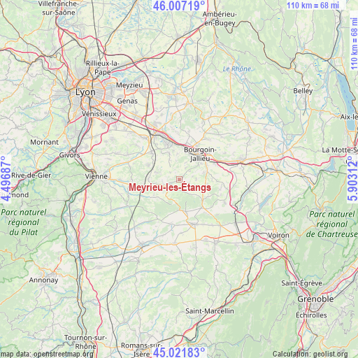
Meyrieu-les-Étangs GPS coordinates[2]
45° 31' 0.012" North, 5° 12' 0" East
| Map corner | latitude | longitude |
|---|---|---|
| Upper-left | 46.00719°, | 4.49687° |
| Center: | 45.51667°, | 5.2° |
| Lower-right: | 45.02183°, | 5.90312° |
| Map W x H: | 109.6×109.6 km | = 68.1×68.1mi |
| max Lat: | 51.07786° ⇑73.9% North |
| Meyrieu-les-Étangs: | 45.51667° |
| min Lat: | ⇓26.1% South 41.3874° |
| min Long | Meyrieu-les-Ét | max Long |
| -5.08615° | 5.2° | 9.52242° |
| W 79.8%⇐ | ⇒20.2% E |
Elevation
Elevation of Meyrieu-les-Étangs is 463 m = 1519 ft, and this is 269.3 m = 884 ft above average elevation for this country.
| Max E: |
2333 m = 7654 ft | 8.5% |
| Meyrieu-les-Étangs | 463 m 1519 ft | |
| Avg. | 193.7 m = 635 ft | |
Min E: |
-1 m = -3 ft | 91.5% |
See also: France elevation on elevation.city.
Geographical zone
Meyrieu-les-Étangs is located in North temperate zone (between Tropic of Cancer and the Arctic Circle). Distance of this North polar circle is 2340.2 km =1454.1 mi to North.| Distance of | km | miles | from Meyrieu-les-Étangs |
|---|---|---|---|
| North Pole | 4946.1 | 3073.4 | to North |
| Arctic Circle | 2340.2 | 1454.1 | to North |
| Tropic Cancer | 2455.1 | 1525.5 | to South |
| Equator | 5061 | 3144.8 | to South |


Nearby cities:
15 places around Meyrieu-les-Étangs: (largest is in red/bold)
• Artas
3.6 km =2.2 mi,  308°
308°
• Badinières
8.1 km =5 mi,  96°
96°
• Charantonnay
7.4 km =4.6 mi,  287°
287°
• Châtonnay
3.4 km =2.1 mi,  164°
164°
• Culin
4.2 km =2.6 mi,  78°
78°
• Domarin
8.6 km =5.3 mi,  24°
24°
• Eclose
8 km =5 mi, 104°
• Four
7.8 km =4.8 mi,  356°
356°
• Les Éparres
7.7 km =4.8 mi,  73°
73°
• Maubec
7.5 km =4.7 mi,  41°
41°
• Meyrié
8.3 km =5.2 mi,  55°
55°
• Roche
8.4 km =5.2 mi,  339°
339°
• Saint-Agnin-sur-Bion
3.8 km =2.4 mi,  48°
48°
• Saint-Jean-de-Bournay
5.1 km =3.2 mi,  250°
250°
• Tramolé
5.4 km =3.4 mi,  88°
88°
Sources, notices
• [Note1] Compared only with cities in France existing in our database
• [Src1] Map data: © OpenStreetMap contributors (CC-BY-SA)
• [Src2] Other city data from geonames.org with taken over terms of usage.
• [Src3] Geographical zone / Annual Mean Temperature by Robert A. Rohde @ Wikipedia
