Lully geodata
Lully (Auvergne-Rhône-Alpes) is a populated place; located in France in Europe/Paris (GMT+2) time zone. With population of 560 people, there are 14001 cities with bigger population in this country. Compared to other cities in France, 62.5% of cities are located further ↑North; 91.2% of cities are located further ←West and 94.8% of cities have lower elevation than Lully. Note1
Administrative division(s):
- Level 1: Auvergne-Rhône-Alpes
- Level 2: Haute-Savoie
- Level 3: Arrondissement de Thonon-les-Bains
- Level 4: Lully


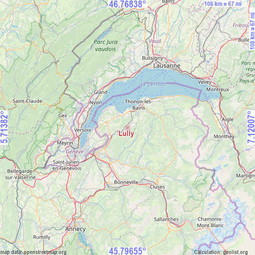
Lully GPS coordinates[2]
46° 17' 4.632" North, 6° 25' 1.02" East
| Map corner | latitude | longitude |
|---|---|---|
| Upper-left | 46.76838°, | 5.71382° |
| Center: | 46.28462°, | 6.41695° |
| Lower-right: | 45.79655°, | 7.12007° |
| Map W x H: | 108.1×108.1 km | = 67.2×67.2mi |
| max Lat: | 51.07786° ⇑62.5% North |
| Lully: | 46.28462° |
| min Lat: | ⇓37.5% South 41.3874° |
| min Long | Lully | max Long |
| -5.08615° | 6.41695° | 9.52242° |
| W 91.2%⇐ | ⇒8.8% E |
Elevation
Elevation of Lully is 579 m = 1900 ft, and this is 385.3 m = 1264 ft above average elevation for this country.
| Max E: |
2333 m = 7654 ft | 5.2% |
| Lully | 579 m 1900 ft | |
| Avg. | 193.7 m = 635 ft | |
Min E: |
-1 m = -3 ft | 94.8% |
See also: France elevation on elevation.city.
Geographical zone
Lully is located in North temperate zone (between Tropic of Cancer and the Arctic Circle). Distance of this North polar circle is 2254.8 km =1401.1 mi to North.| Distance of | km | miles | from Lully |
|---|---|---|---|
| North Pole | 4860.7 | 3020.3 | to North |
| Arctic Circle | 2254.8 | 1401.1 | to North |
| Tropic Cancer | 2540.4 | 1578.5 | to South |
| Equator | 5146.4 | 3197.8 | to South |


Nearby cities:
15 places around Lully: (largest is in red/bold)
• Allinges
6.7 km =4.2 mi,  32°
32°
• Ballaison
7 km =4.3 mi,  282°
282°
• Bons-en-Chablais
4.1 km =2.5 mi,  237°
237°
• Brenthonne
2.1 km =1.3 mi,  227°
227°
• Burdignin
7 km =4.3 mi,  175°
175°
• Cervens
1.8 km =1.1 mi,  85°
85°
• Draillant
3.9 km =2.4 mi,  55°
55°
• Fessy
1.2 km =0.7 mi,  195°
195°
• Habère-Lullin
6.3 km =3.9 mi,  152°
152°
• Habère-Poche
5.8 km =3.6 mi,  132°
132°
• Machilly
7.5 km =4.7 mi, 239°
• Margencel
6.3 km =3.9 mi,  358°
358°
• Orcier
6.4 km =4 mi, 60°
• Perrignier
2.9 km =1.8 mi,  36°
36°
• Sciez
5.9 km =3.7 mi,  334°
334°
Sources, notices
• [Note1] Compared only with cities in France existing in our database
• [Src1] Map data: © OpenStreetMap contributors (CC-BY-SA)
• [Src2] Other city data from geonames.org with taken over terms of usage.
• [Src3] Geographical zone / Annual Mean Temperature by Robert A. Rohde @ Wikipedia
