Livry-Louvercy geodata
Livry-Louvercy (Grand Est) is a populated place; located in France in Europe/Paris (GMT+2) time zone. With population of 837 people, there are 10216 cities with bigger population in this country. Compared to other cities in France, 82.1% of cities are located further ↓South; 70.6% of cities are located further ←West and 59.1% of cities have higher elevation than Livry-Louvercy. Note1
Administrative division(s):
- Level 1: Grand Est
- Level 2: Marne
- Level 3: Arrondissement de Châlons-en-Champagne
- Level 4: Livry-Louvercy


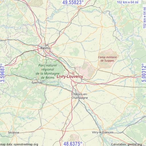
Livry-Louvercy GPS coordinates[2]
49° 6' 0" North, 4° 18' 0" East
| Map corner | latitude | longitude |
|---|---|---|
| Upper-left | 49.55823°, | 3.59687° |
| Center: | 49.1°, | 4.3° |
| Lower-right: | 48.6375°, | 5.00312° |
| Map W x H: | 102.4×102.4 km | = 63.6×63.6mi |
| max Lat: | 51.07786° ⇑17.9% North |
| Livry-Louvercy: | 49.1° |
| min Lat: | ⇓82.1% South 41.3874° |
| min Long | Livry-Louvercy | max Long |
| -5.08615° | 4.3° | 9.52242° |
| W 70.6%⇐ | ⇒29.4% E |
Elevation
Elevation of Livry-Louvercy is 105 m = 344 ft, and this is 88.7 m = 291 ft below average elevation for this country.
| Max E: |
2333 m = 7654 ft | 59.1% |
| Avg. | 193.7 m = 635 ft | |
| Livry-Louvercy | 105 m = 344 ft | |
Min E: |
-1 m = -3 ft | 40.9% |
See also: France elevation on elevation.city.
Geographical zone
Livry-Louvercy is located in North temperate zone (between Tropic of Cancer and the Arctic Circle). Distance of this North polar circle is 1941.8 km =1206.6 mi to North.| Distance of | km | miles | from Livry-Louvercy |
|---|---|---|---|
| North Pole | 4547.7 | 2825.8 | to North |
| Arctic Circle | 1941.8 | 1206.6 | to North |
| Tropic Cancer | 2853.5 | 1773.1 | to South |
| Equator | 5459.4 | 3392.3 | to South |


Nearby cities:
15 places around Livry-Louvercy: (largest is in red/bold)
• Ambonnay
9.6 km =6 mi,  254°
254°
• Beaumont-sur-Vesle
11.6 km =7.2 mi,  315°
315°
• Bouzy
11.3 km =7 mi,  258°
258°
• Condé-sur-Marne
10.7 km =6.6 mi,  234°
234°
• Juvigny
9.4 km =5.8 mi,  196°
196°
• Jâlons
12.9 km =8 mi,  219°
219°
• La Veuve
7.8 km =4.8 mi,  170°
170°
• Matougues
12.5 km =7.8 mi, 199°
• Mourmelon-le-Grand
5.9 km =3.7 mi,  52°
52°
• Mourmelon-le-Petit
3.5 km =2.2 mi,  16°
16°
• Recy
12.4 km =7.7 mi,  175°
175°
• Sept-Saulx
6.3 km =3.9 mi,  328°
328°
• Verzenay
13 km =8.1 mi,  300°
300°
• Verzy
11.1 km =6.9 mi, 297°
• Villers-Marmery
8.5 km =5.3 mi, 297°
Sources, notices
• [Note1] Compared only with cities in France existing in our database
• [Src1] Map data: © OpenStreetMap contributors (CC-BY-SA)
• [Src2] Other city data from geonames.org with taken over terms of usage.
• [Src3] Geographical zone / Annual Mean Temperature by Robert A. Rohde @ Wikipedia
