Juvigny geodata
Juvigny (Grand Est) is a populated place; located in France in Europe/Paris (GMT+2) time zone. With population of 911 people, there are 9566 cities with bigger population in this country. Compared to other cities in France, 80.2% of cities are located further ↓South; 70.3% of cities are located further ←West and 69.7% of cities have higher elevation than Juvigny. Note1
Administrative division(s):
- Level 1: Grand Est
- Level 2: Marne
- Level 3: Arrondissement de Châlons-en-Champagne
- Level 4: Juvigny


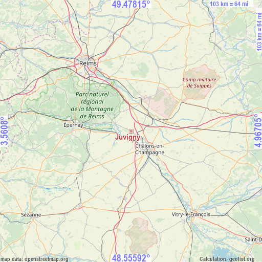
Juvigny GPS coordinates[2]
49° 1' 9.012" North, 4° 15' 50.148" East
| Map corner | latitude | longitude |
|---|---|---|
| Upper-left | 49.47815°, | 3.5608° |
| Center: | 49.01917°, | 4.26393° |
| Lower-right: | 48.55592°, | 4.96705° |
| Map W x H: | 102.5×102.5 km | = 63.7×63.7mi |
| max Lat: | 51.07786° ⇑19.8% North |
| Juvigny: | 49.01917° |
| min Lat: | ⇓80.2% South 41.3874° |
| min Long | Juvigny | max Long |
| -5.08615° | 4.26393° | 9.52242° |
| W 70.3%⇐ | ⇒29.7% E |
Elevation
Elevation of Juvigny is 79 m = 259 ft, and this is 114.7 m = 376 ft below average elevation for this country.
| Max E: |
2333 m = 7654 ft | 69.7% |
| Avg. | 193.7 m = 635 ft | |
| Juvigny | 79 m = 259 ft | |
Min E: |
-1 m = -3 ft | 30.3% |
See also: France elevation on elevation.city.
Geographical zone
Juvigny is located in North temperate zone (between Tropic of Cancer and the Arctic Circle). Distance of this North polar circle is 1950.8 km =1212.2 mi to North.| Distance of | km | miles | from Juvigny |
|---|---|---|---|
| North Pole | 4556.6 | 2831.3 | to North |
| Arctic Circle | 1950.8 | 1212.2 | to North |
| Tropic Cancer | 2844.5 | 1767.5 | to South |
| Equator | 5450.4 | 3386.7 | to South |


Nearby cities:
15 places around Juvigny: (largest is in red/bold)
• Ambonnay
9.3 km =5.8 mi,  314°
314°
• Athis
9.9 km =6.2 mi,  268°
268°
• Bouzy
10.8 km =6.7 mi, 308°
• Châlons-en-Champagne
10.5 km =6.5 mi,  133°
133°
• Compertrix
10.5 km =6.5 mi,  145°
145°
• Condé-sur-Marne
6.7 km =4.2 mi,  294°
294°
• Fagnières
7.3 km =4.5 mi, 147°
• Jâlons
5.7 km =3.5 mi,  260°
260°
• La Veuve
4.1 km =2.5 mi,  72°
72°
• Livry-Louvercy
9.4 km =5.8 mi,  16°
16°
• Matougues
3.2 km =2 mi,  208°
208°
• Recy
5 km =3.1 mi, 132°
• Saint-Martin-sur-le-Pré
7.2 km =4.5 mi, 130°
• Saint-Memmie
11.5 km =7.1 mi, 130°
• Tours-sur-Marne
11 km =6.8 mi, 287°
Sources, notices
• [Note1] Compared only with cities in France existing in our database
• [Src1] Map data: © OpenStreetMap contributors (CC-BY-SA)
• [Src2] Other city data from geonames.org with taken over terms of usage.
• [Src3] Geographical zone / Annual Mean Temperature by Robert A. Rohde @ Wikipedia
