Leyment geodata
Leyment (Auvergne-Rhône-Alpes) is a populated place; located in France in Europe/Paris (GMT+2) time zone. With population of 1,011 people, there are 8765 cities with bigger population in this country. Compared to other cities in France, 67.2% of cities are located further ↑North; 80.5% of cities are located further ←West and 77.3% of cities have lower elevation than Leyment. Note1
Administrative division(s):
- Level 1: Auvergne-Rhône-Alpes
- Level 2: Département de l'Ain
- Level 3: Arrondissement de Belley
- Level 4: Leyment


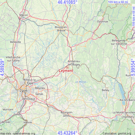
Leyment GPS coordinates[2]
45° 55' 26.04" North, 5° 17' 32.676" East
| Map corner | latitude | longitude |
|---|---|---|
| Upper-left | 46.41085°, | 4.58929° |
| Center: | 45.9239°, | 5.29241° |
| Lower-right: | 45.43264°, | 5.99554° |
| Map W x H: | 108.8×108.8 km | = 67.6×67.6mi |
| max Lat: | 51.07786° ⇑67.2% North |
| Leyment: | 45.9239° |
| min Lat: | ⇓32.8% South 41.3874° |
| min Long | Leyment | max Long |
| -5.08615° | 5.29241° | 9.52242° |
| W 80.5%⇐ | ⇒19.5% E |
Elevation
Elevation of Leyment is 266 m = 873 ft, and this is 72.3 m = 237 ft above average elevation for this country.
| Max E: |
2333 m = 7654 ft | 22.7% |
| Leyment | 266 m 873 ft | |
| Avg. | 193.7 m = 635 ft | |
Min E: |
-1 m = -3 ft | 77.3% |
See also: France elevation on elevation.city.
Geographical zone
Leyment is located in North temperate zone (between Tropic of Cancer and the Arctic Circle). Distance of this North polar circle is 2294.9 km =1426 mi to North.| Distance of | km | miles | from Leyment |
|---|---|---|---|
| North Pole | 4900.8 | 3045.2 | to North |
| Arctic Circle | 2294.9 | 1426 | to North |
| Tropic Cancer | 2500.3 | 1553.6 | to South |
| Equator | 5106.3 | 3172.9 | to South |


Nearby cities:
15 places around Leyment: (largest is in red/bold)
• Ambutrix
3.9 km =2.4 mi,  66°
66°
• Ambérieu-en-Bugey
6 km =3.7 mi,  49°
49°
• Bettant
5.6 km =3.5 mi, 66°
• Chazey-sur-Ain
4.6 km =2.9 mi,  221°
221°
• Château-Gaillard
5.5 km =3.4 mi,  9°
9°
• Châtillon-la-Palud
6.1 km =3.8 mi,  330°
330°
• Lagnieu
4.7 km =2.9 mi,  120°
120°
• Meximieux
7.4 km =4.6 mi,  256°
256°
• Saint-Denis-en-Bugey
4 km =2.5 mi,  43°
43°
• Saint-Maurice-de-Rémens
4 km =2.5 mi,  339°
339°
• Saint-Sorlin-en-Bugey
7.2 km =4.5 mi,  126°
126°
• Sainte-Julie
3.9 km =2.4 mi,  195°
195°
• Torcieu
7.8 km =4.8 mi,  90°
90°
• Vaux-en-Bugey
4.6 km =2.9 mi, 86°
• Vertrieu
7.6 km =4.7 mi,  135°
135°
Sources, notices
• [Note1] Compared only with cities in France existing in our database
• [Src1] Map data: © OpenStreetMap contributors (CC-BY-SA)
• [Src2] Other city data from geonames.org with taken over terms of usage.
• [Src3] Geographical zone / Annual Mean Temperature by Robert A. Rohde @ Wikipedia
