Le Perray-en-Yvelines geodata
Le Perray-en-Yvelines (Île-de-France) is a populated place; located in France in Europe/Paris (GMT+2) time zone. With population of 6,206 people, there are 1595 cities with bigger population in this country. Compared to other cities in France, 73.1% of cities are located further ↓South; 58.7% of cities are located further →East and 61% of cities have lower elevation than Le Perray-en-Yvelines. Note1
Administrative division(s):
- Level 1: Île-de-France
- Level 2: Yvelines
- Level 3: Arrondissement de Rambouillet
- Level 4: Le Perray-en-Yvelines
Current local time in Le Perray-en-Yvelines:
11:06 AM, WednesdayDifference from your time zone: hours


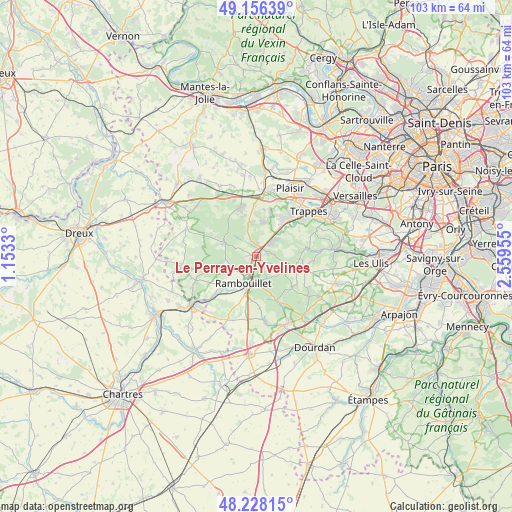
Le Perray-en-Yvelines GPS coordinates[2]
48° 41' 39.876" North, 1° 51' 23.148" East
| Map corner | latitude | longitude |
|---|---|---|
| Upper-left | 49.15639°, | 1.1533° |
| Center: | 48.69441°, | 1.85643° |
| Lower-right: | 48.22815°, | 2.55955° |
| Map W x H: | 103.2×103.2 km | = 64.1×64.1mi |
| max Lat: | 51.07786° ⇑26.9% North |
| Le Perray-en-Yvelines: | 48.69441° |
| min Lat: | ⇓73.1% South 41.3874° |
| min Long | Le Perray-en-Yv | max Long |
| -5.08615° | 1.85643° | 9.52242° |
| W 41.3%⇐ | ⇒58.7% E |
Elevation
Elevation of Le Perray-en-Yvelines is 175 m = 574 ft, and this is 18.7 m = 61 ft below average elevation for this country.
| Max E: |
2333 m = 7654 ft | 39% |
| Avg. | 193.7 m = 635 ft | |
| Le Perray-en-Yvelines | 175 m = 574 ft | |
Min E: |
-1 m = -3 ft | 61% |
See also: France elevation on elevation.city.
Geographical zone
Le Perray-en-Yvelines is located in North temperate zone (between Tropic of Cancer and the Arctic Circle). Distance of this North polar circle is 1986.9 km =1234.6 mi to North.| Distance of | km | miles | from Le Perray-en-Yvelines |
|---|---|---|---|
| North Pole | 4592.8 | 2853.8 | to North |
| Arctic Circle | 1986.9 | 1234.6 | to North |
| Tropic Cancer | 2808.4 | 1745.1 | to South |
| Equator | 5414.3 | 3364.3 | to South |


Nearby cities:
15 places around Le Perray-en-Yvelines: (largest is in red/bold)
• Auffargis
2.3 km =1.4 mi,  73°
73°
• Cernay-la-Ville
9 km =5.6 mi,  105°
105°
• Coignières
7.8 km =4.8 mi,  37°
37°
• Dampierre-en-Yvelines
9.3 km =5.8 mi,  86°
86°
• La Verrière
9.2 km =5.7 mi,  45°
45°
• Le Mesnil-Saint-Denis
9.2 km =5.7 mi, 52°
• Les Bréviaires
3.5 km =2.2 mi,  295°
295°
• Les Essarts-le-Roi
4.1 km =2.5 mi, 52°
• Les Mesnuls
7 km =4.3 mi,  352°
352°
• Lévis-Saint-Nom
7.3 km =4.5 mi, 70°
• Poigny-la-Forêt
7.6 km =4.7 mi,  257°
257°
• Rambouillet
6 km =3.7 mi,  199°
199°
• Saint-Léger-en-Yvelines
7.3 km =4.5 mi,  294°
294°
• Senlisse
9.2 km =5.7 mi, 94°
• Vieille-Église-en-Yvelines
3.4 km =2.1 mi,  154°
154°
Sources, notices
• [Note1] Compared only with cities in France existing in our database
• [Src1] Map data: © OpenStreetMap contributors (CC-BY-SA)
• [Src2] Other city data from geonames.org with taken over terms of usage.
• [Src3] Geographical zone / Annual Mean Temperature by Robert A. Rohde @ Wikipedia
