Coignières geodata
Coignières (Île-de-France) is a populated place; located in France in Europe/Paris (GMT+2) time zone. With population of 4,439 people, there are 2219 cities with bigger population in this country. Compared to other cities in France, 74.3% of cities are located further ↓South; 58% of cities are located further →East and 61.3% of cities have lower elevation than Coignières. Note1
Administrative division(s):
- Level 1: Île-de-France
- Level 2: Yvelines
- Level 3: Arrondissement de Rambouillet
- Level 4: Coignières


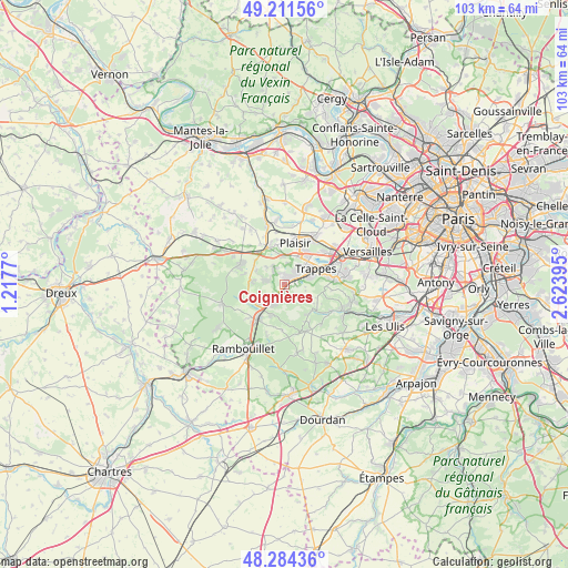
Coignières GPS coordinates[2]
48° 45' 0.36" North, 1° 55' 14.952" East
| Map corner | latitude | longitude |
|---|---|---|
| Upper-left | 49.21156°, | 1.2177° |
| Center: | 48.7501°, | 1.92082° |
| Lower-right: | 48.28436°, | 2.62395° |
| Map W x H: | 103.1×103.1 km | = 64.1×64.1mi |
| max Lat: | 51.07786° ⇑25.7% North |
| Coignières: | 48.7501° |
| min Lat: | ⇓74.3% South 41.3874° |
| min Long | Coignières | max Long |
| -5.08615° | 1.92082° | 9.52242° |
| W 42%⇐ | ⇒58% E |
Elevation
Elevation of Coignières is 176 m = 577 ft, and this is 17.7 m = 58 ft below average elevation for this country.
| Max E: |
2333 m = 7654 ft | 38.7% |
| Avg. | 193.7 m = 635 ft | |
| Coignières | 176 m = 577 ft | |
Min E: |
-1 m = -3 ft | 61.3% |
See also: France elevation on elevation.city.
Geographical zone
Coignières is located in North temperate zone (between Tropic of Cancer and the Arctic Circle). Distance of this North polar circle is 1980.7 km =1230.7 mi to North.| Distance of | km | miles | from Coignières |
|---|---|---|---|
| North Pole | 4586.6 | 2850 | to North |
| Arctic Circle | 1980.7 | 1230.7 | to North |
| Tropic Cancer | 2814.6 | 1748.9 | to South |
| Equator | 5420.5 | 3368.1 | to South |


Nearby cities:
15 places around Coignières: (largest is in red/bold)
• Auffargis
6 km =3.7 mi,  204°
204°
• Bazoches-sur-Guyonne
5.7 km =3.5 mi,  303°
303°
• Dampierre-en-Yvelines
7.2 km =4.5 mi,  140°
140°
• Jouars-Pontchartrain
4.6 km =2.9 mi,  339°
339°
• La Verrière
1.9 km =1.2 mi,  83°
83°
• Le Mesnil-Saint-Denis
2.6 km =1.6 mi,  102°
102°
• Le Tremblay-sur-Mauldre
4.4 km =2.7 mi,  314°
314°
• Les Essarts-le-Roi
4 km =2.5 mi, 201°
• Les Mesnuls
5.6 km =3.5 mi,  277°
277°
• Lévis-Saint-Nom
4.3 km =2.7 mi,  150°
150°
• Maurepas
1.8 km =1.1 mi,  20°
20°
• Neauphle-le-Château
7.2 km =4.5 mi,  351°
351°
• Saint-Quentin-en-Yvelines
7.6 km =4.7 mi,  71°
71°
• Trappes
7.6 km =4.7 mi, 69°
• Élancourt
4.6 km =2.9 mi,  33°
33°
Sources, notices
• [Note1] Compared only with cities in France existing in our database
• [Src1] Map data: © OpenStreetMap contributors (CC-BY-SA)
• [Src2] Other city data from geonames.org with taken over terms of usage.
• [Src3] Geographical zone / Annual Mean Temperature by Robert A. Rohde @ Wikipedia
