La Mailleraye-sur-Seine geodata
La Mailleraye-sur-Seine (Normandy) is a populated place; located in France in Europe/Paris (GMT+2) time zone. With population of 1,916 people, there are 4998 cities with bigger population in this country. Compared to other cities in France, 89% of cities are located further ↓South; 70.8% of cities are located further →East and 94.4% of cities have higher elevation than La Mailleraye-sur-Seine. Note1
Administrative division(s):
- Level 1: Normandy
- Level 2: Seine-Maritime
- Level 3: Arrondissement de Rouen
- Level 4: Arelaune-en-Seine
Current local time in La Mailleraye-sur-Seine:
07:20 AM, SaturdayDifference from your time zone: hours


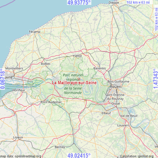
La Mailleraye-sur-Seine GPS coordinates[2]
49° 28' 59.088" North, 0° 46' 13.08" East
| Map corner | latitude | longitude |
|---|---|---|
| Upper-left | 49.93775°, | 0.06718° |
| Center: | 49.48308°, | 0.7703° |
| Lower-right: | 49.02415°, | 1.47343° |
| Map W x H: | 101.6×101.6 km | = 63.1×63.1mi |
| max Lat: | 51.07786° ⇑11% North |
| La Mailleraye-sur-Seine: | 49.48308° |
| min Lat: | ⇓89% South 41.3874° |
| min Long | La Mailleraye-s | max Long |
| -5.08615° | 0.7703° | 9.52242° |
| W 29.2%⇐ | ⇒70.8% E |
Elevation
Elevation of La Mailleraye-sur-Seine is 19 m = 62 ft, and this is 174.7 m = 573 ft below average elevation for this country.
| Max E: |
2333 m = 7654 ft | 94.4% |
| Avg. | 193.7 m = 635 ft | |
| La Mailleraye-sur-Seine | 19 m = 62 ft | |
Min E: |
-1 m = -3 ft | 5.6% |
See also: France elevation on elevation.city.
Geographical zone
La Mailleraye-sur-Seine is located in North temperate zone (between Tropic of Cancer and the Arctic Circle). Distance of this North polar circle is 1899.2 km =1180.1 mi to North.| Distance of | km | miles | from La Mailleraye-sur-Seine |
|---|---|---|---|
| North Pole | 4505.1 | 2799.3 | to North |
| Arctic Circle | 1899.2 | 1180.1 | to North |
| Tropic Cancer | 2896.1 | 1799.6 | to South |
| Equator | 5502 | 3418.8 | to South |


Nearby cities:
15 places around La Mailleraye-sur-Seine: (largest is in red/bold)
• Anneville-Ambourville
8.7 km =5.4 mi,  106°
106°
• Caudebec-en-Caux
5.7 km =3.5 mi,  325°
325°
• Duclair
7.6 km =4.7 mi,  89°
89°
• Jumièges
6.6 km =4.1 mi,  147°
147°
• Le Trait
3.7 km =2.3 mi,  115°
115°
• Maulévrier-Sainte-Gertrude
7.9 km =4.9 mi,  340°
340°
• Notre-Dame-de-Bliquetuit
1.1 km =0.7 mi, 337°
• Saint-Arnoult
8.6 km =5.3 mi,  304°
304°
• Saint-Nicolas-de-Bliquetuit
3.9 km =2.4 mi,  315°
315°
• Saint-Paër
8.6 km =5.3 mi,  66°
66°
• Saint-Wandrille-Rançon
4.9 km =3 mi,  355°
355°
• Sainte-Marguerite-sur-Duclair
6 km =3.7 mi,  61°
61°
• Vatteville-la-Rue
6.6 km =4.1 mi,  286°
286°
• Villequier
7.7 km =4.8 mi, 295°
• Yainville
5.4 km =3.4 mi,  127°
127°
Sources, notices
• [Note1] Compared only with cities in France existing in our database
• [Src1] Map data: © OpenStreetMap contributors (CC-BY-SA)
• [Src2] Other city data from geonames.org with taken over terms of usage.
• [Src3] Geographical zone / Annual Mean Temperature by Robert A. Rohde @ Wikipedia
