Jouy-sous-Thelle geodata
Jouy-sous-Thelle (Hauts-de-France) is a populated place; located in France in Europe/Paris (GMT+2) time zone. With population of 854 people, there are 10043 cities with bigger population in this country. Compared to other cities in France, 86.7% of cities are located further ↓South; 57.5% of cities are located further →East and 65.8% of cities have lower elevation than Jouy-sous-Thelle. Note1
Administrative division(s):
- Level 1: Hauts-de-France
- Level 2: Département de l'Oise
- Level 3: Arrondissement de Beauvais
- Level 4: Jouy-sous-Thelle


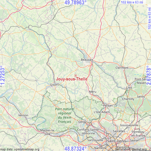
Jouy-sous-Thelle GPS coordinates[2]
49° 20' 0.852" North, 1° 58' 32.34" East
| Map corner | latitude | longitude |
|---|---|---|
| Upper-left | 49.78963°, | 1.27253° |
| Center: | 49.33357°, | 1.97565° |
| Lower-right: | 48.87324°, | 2.67878° |
| Map W x H: | 101.9×101.9 km | = 63.3×63.3mi |
| max Lat: | 51.07786° ⇑13.3% North |
| Jouy-sous-Thelle: | 49.33357° |
| min Lat: | ⇓86.7% South 41.3874° |
| min Long | Jouy-sous-Thell | max Long |
| -5.08615° | 1.97565° | 9.52242° |
| W 42.5%⇐ | ⇒57.5% E |
Elevation
Elevation of Jouy-sous-Thelle is 198 m = 650 ft, and this is 4.3 m = 14 ft above average elevation for this country.
| Max E: |
2333 m = 7654 ft | 34.2% |
| Jouy-sous-Thelle | 198 m 650 ft | |
| Avg. | 193.7 m = 635 ft | |
Min E: |
-1 m = -3 ft | 65.8% |
See also: France elevation on elevation.city.
Geographical zone
Jouy-sous-Thelle is located in North temperate zone (between Tropic of Cancer and the Arctic Circle). Distance of this North polar circle is 1915.8 km =1190.4 mi to North.| Distance of | km | miles | from Jouy-sous-Thelle |
|---|---|---|---|
| North Pole | 4521.7 | 2809.7 | to North |
| Arctic Circle | 1915.8 | 1190.4 | to North |
| Tropic Cancer | 2879.5 | 1789.2 | to South |
| Equator | 5485.4 | 3408.5 | to South |


Nearby cities:
15 places around Jouy-sous-Thelle: (largest is in red/bold)
• Auneuil
4.4 km =2.7 mi,  20°
20°
• Auteuil
8.1 km =5 mi,  83°
83°
• Aux Marais
10.2 km =6.3 mi,  27°
27°
• Berneuil-en-Bray
6.8 km =4.2 mi,  74°
74°
• Chaumont-en-Vexin
9.9 km =6.2 mi,  220°
220°
• Fresneaux-Montchevreuil
6.2 km =3.9 mi,  160°
160°
• Frocourt
9.6 km =6 mi,  55°
55°
• La Houssoye
3.4 km =2.1 mi,  314°
314°
• Le Mesnil-Théribus
3.7 km =2.3 mi,  166°
166°
• Le Vauroux
6.3 km =3.9 mi,  323°
323°
• Ons-en-Bray
10 km =6.2 mi,  337°
337°
• Rainvillers
8.3 km =5.2 mi, 16°
• Saint-Martin-le-Nœud
9.3 km =5.8 mi,  41°
41°
• Valdampierre
6.5 km =4 mi,  120°
120°
• Villers-Saint-Barthélemy
7.4 km =4.6 mi, 344°
Sources, notices
• [Note1] Compared only with cities in France existing in our database
• [Src1] Map data: © OpenStreetMap contributors (CC-BY-SA)
• [Src2] Other city data from geonames.org with taken over terms of usage.
• [Src3] Geographical zone / Annual Mean Temperature by Robert A. Rohde @ Wikipedia
