Frocourt geodata
Frocourt (Hauts-de-France) is a populated place; located in France in Europe/Paris (GMT+2) time zone. With population of 543 people, there are 14333 cities with bigger population in this country. Compared to other cities in France, 87.6% of cities are located further ↓South; 56% of cities are located further →East and 66.6% of cities have higher elevation than Frocourt. Note1
Administrative division(s):
- Level 1: Hauts-de-France
- Level 2: Département de l'Oise
- Level 3: Arrondissement de Beauvais
- Level 4: Frocourt


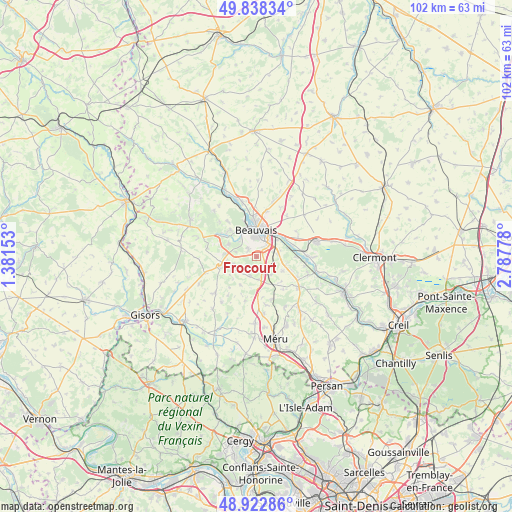
Frocourt GPS coordinates[2]
49° 22' 57.828" North, 2° 5' 4.74" East
| Map corner | latitude | longitude |
|---|---|---|
| Upper-left | 49.83834°, | 1.38153° |
| Center: | 49.38273°, | 2.08465° |
| Lower-right: | 48.92286°, | 2.78778° |
| Map W x H: | 101.8×101.8 km | = 63.3×63.3mi |
| max Lat: | 51.07786° ⇑12.4% North |
| Frocourt: | 49.38273° |
| min Lat: | ⇓87.6% South 41.3874° |
| min Long | Frocourt | max Long |
| -5.08615° | 2.08465° | 9.52242° |
| W 44%⇐ | ⇒56% E |
Elevation
Elevation of Frocourt is 86 m = 282 ft, and this is 107.7 m = 353 ft below average elevation for this country.
| Max E: |
2333 m = 7654 ft | 66.6% |
| Avg. | 193.7 m = 635 ft | |
| Frocourt | 86 m = 282 ft | |
Min E: |
-1 m = -3 ft | 33.4% |
See also: France elevation on elevation.city.
Geographical zone
Frocourt is located in North temperate zone (between Tropic of Cancer and the Arctic Circle). Distance of this North polar circle is 1910.3 km =1187 mi to North.| Distance of | km | miles | from Frocourt |
|---|---|---|---|
| North Pole | 4516.2 | 2806.2 | to North |
| Arctic Circle | 1910.3 | 1187 | to North |
| Tropic Cancer | 2884.9 | 1792.6 | to South |
| Equator | 5490.8 | 3411.8 | to South |


Nearby cities:
15 places around Frocourt: (largest is in red/bold)
• Allonne
3.6 km =2.2 mi,  36°
36°
• Auneuil
6.5 km =4 mi,  257°
257°
• Auteuil
4.5 km =2.8 mi,  177°
177°
• Aux Marais
4.7 km =2.9 mi,  319°
319°
• Beauvais
5.6 km =3.5 mi,  359°
359°
• Berneuil-en-Bray
3.9 km =2.4 mi,  199°
199°
• Goincourt
6 km =3.7 mi, 324°
• Ponchon
9.1 km =5.7 mi,  116°
116°
• Rainvillers
6.1 km =3.8 mi,  294°
294°
• Rochy-Condé
7.5 km =4.7 mi,  74°
74°
• Saint-Martin-le-Nœud
2.3 km =1.4 mi,  311°
311°
• Saint-Paul
7.6 km =4.7 mi, 313°
• Saint-Sulpice
4.5 km =2.8 mi,  142°
142°
• Therdonne
6.7 km =4.2 mi,  53°
53°
• Warluis
4.2 km =2.6 mi,  80°
80°
Sources, notices
• [Note1] Compared only with cities in France existing in our database
• [Src1] Map data: © OpenStreetMap contributors (CC-BY-SA)
• [Src2] Other city data from geonames.org with taken over terms of usage.
• [Src3] Geographical zone / Annual Mean Temperature by Robert A. Rohde @ Wikipedia
