Forges geodata
Forges (Nouvelle-Aquitaine) is a populated place; located in France in Europe/Paris (GMT+2) time zone. With population of 959 people, there are 9134 cities with bigger population in this country. Compared to other cities in France, 65% of cities are located further ↑North; 87.3% of cities are located further →East and 94.7% of cities have higher elevation than Forges. Note1
Administrative division(s):
- Level 1: Nouvelle-Aquitaine
- Level 2: Charente-Maritime
- Level 3: Arrondissement de Rochefort
- Level 4: Forges


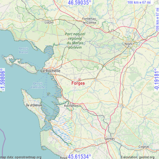
Forges GPS coordinates[2]
46° 6' 18" North, 0° 53' 41.784" West
| Map corner | latitude | longitude |
|---|---|---|
| Upper-left | 46.59035°, | -1.59806° |
| Center: | 46.105°, | -0.89494° |
| Lower-right: | 45.61534°, | -0.19181° |
| Map W x H: | 108.4×108.4 km | = 67.4×67.4mi |
| max Lat: | 51.07786° ⇑65% North |
| Forges: | 46.105° |
| min Lat: | ⇓35% South 41.3874° |
| min Long | Forges | max Long |
| -5.08615° | -0.89494° | 9.52242° |
| W 12.7%⇐ | ⇒87.3% E |
Elevation
Elevation of Forges is 18 m = 59 ft, and this is 175.7 m = 576 ft below average elevation for this country.
| Max E: |
2333 m = 7654 ft | 94.7% |
| Avg. | 193.7 m = 635 ft | |
| Forges | 18 m = 59 ft | |
Min E: |
-1 m = -3 ft | 5.3% |
See also: France elevation on elevation.city.
Geographical zone
Forges is located in North temperate zone (between Tropic of Cancer and the Arctic Circle). Distance of this North polar circle is 2274.8 km =1413.5 mi to North.| Distance of | km | miles | from Forges |
|---|---|---|---|
| North Pole | 4880.7 | 3032.7 | to North |
| Arctic Circle | 2274.8 | 1413.5 | to North |
| Tropic Cancer | 2520.5 | 1566.2 | to South |
| Equator | 5126.4 | 3185.4 | to South |


Nearby cities:
15 places around Forges: (largest is in red/bold)
• Ardillières
5.1 km =3.2 mi,  178°
178°
• Ballon
6.9 km =4.3 mi,  219°
219°
• Chambon
4.3 km =2.7 mi,  53°
53°
• Ciré-d’Aunis
6.2 km =3.9 mi,  206°
206°
• Clavette
11 km =6.8 mi,  291°
291°
• Croix-Chapeau
8.9 km =5.5 mi,  273°
273°
• La Jarrie
9.2 km =5.7 mi, 286°
• Landrais
4.7 km =2.9 mi,  146°
146°
• Le Thou
2.9 km =1.8 mi, 214°
• Montroy
10.6 km =6.6 mi,  302°
302°
• Muron
9.4 km =5.8 mi, 146°
• Saint-Christophe
6.1 km =3.8 mi,  317°
317°
• Saint-Germain-de-Marencennes
8.6 km =5.3 mi,  111°
111°
• Surgères
11.1 km =6.9 mi,  88°
88°
• Thairé
9 km =5.6 mi,  247°
247°
Sources, notices
• [Note1] Compared only with cities in France existing in our database
• [Src1] Map data: © OpenStreetMap contributors (CC-BY-SA)
• [Src2] Other city data from geonames.org with taken over terms of usage.
• [Src3] Geographical zone / Annual Mean Temperature by Robert A. Rohde @ Wikipedia
