Fauverney geodata
Fauverney (Bourgogne-Franche-Comté) is a populated place; located in France in Europe/Paris (GMT+2) time zone. With population of 706 people, there are 11718 cities with bigger population in this country. Compared to other cities in France, 52.2% of cities are located further ↑North; 79.2% of cities are located further ←West and 69.6% of cities have lower elevation than Fauverney. Note1
Administrative division(s):
- Level 1: Bourgogne-Franche-Comté
- Level 2: Département de la Côte-d'Or
- Level 3: Arrondissement de Dijon
- Level 4: Fauverney


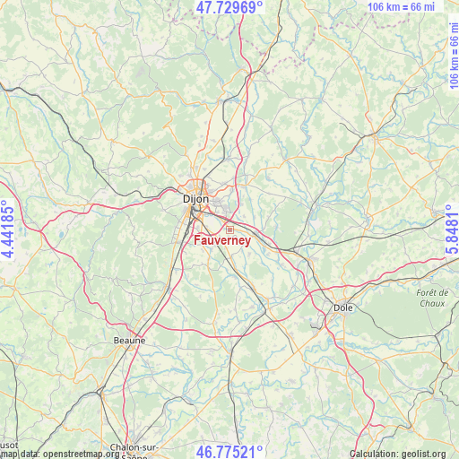
Fauverney GPS coordinates[2]
47° 15' 16.56" North, 5° 8' 41.892" East
| Map corner | latitude | longitude |
|---|---|---|
| Upper-left | 47.72969°, | 4.44185° |
| Center: | 47.2546°, | 5.14497° |
| Lower-right: | 46.77521°, | 5.8481° |
| Map W x H: | 106.1×106.1 km | = 65.9×65.9mi |
| max Lat: | 51.07786° ⇑52.2% North |
| Fauverney: | 47.2546° |
| min Lat: | ⇓47.8% South 41.3874° |
| min Long | Fauverney | max Long |
| -5.08615° | 5.14497° | 9.52242° |
| W 79.2%⇐ | ⇒20.8% E |
Elevation
Elevation of Fauverney is 217 m = 712 ft, and this is 23.3 m = 76 ft above average elevation for this country.
| Max E: |
2333 m = 7654 ft | 30.4% |
| Fauverney | 217 m 712 ft | |
| Avg. | 193.7 m = 635 ft | |
Min E: |
-1 m = -3 ft | 69.6% |
See also: France elevation on elevation.city.
Geographical zone
Fauverney is located in North temperate zone (between Tropic of Cancer and the Arctic Circle). Distance of this North polar circle is 2147 km =1334.1 mi to North.| Distance of | km | miles | from Fauverney |
|---|---|---|---|
| North Pole | 4752.8 | 2953.3 | to North |
| Arctic Circle | 2147 | 1334.1 | to North |
| Tropic Cancer | 2648.3 | 1645.6 | to South |
| Equator | 5254.2 | 3264.8 | to South |


Nearby cities:
15 places around Fauverney: (largest is in red/bold)
• Bressey-sur-Tille
6.6 km =4.1 mi,  25°
25°
• Bretenière
2.8 km =1.7 mi,  236°
236°
• Chevigny-Saint-Sauveur
5 km =3.1 mi,  350°
350°
• Crimolois
2.8 km =1.7 mi,  319°
319°
• Genlis
6.1 km =3.8 mi,  103°
103°
• Izier
4.5 km =2.8 mi,  48°
48°
• Longecourt-en-Plaine
6.3 km =3.9 mi,  176°
176°
• Magny-sur-Tille
3.1 km =1.9 mi,  40°
40°
• Neuilly-lès-Dijon
4 km =2.5 mi,  313°
313°
• Ouges
5.4 km =3.4 mi,  278°
278°
• Rouvres-en-Plaine
1.7 km =1.1 mi,  188°
188°
• Saulon-la-Chapelle
6.1 km =3.8 mi,  223°
223°
• Sennecey-lès-Dijon
5 km =3.1 mi, 322°
• Thorey-en-Plaine
4.4 km =2.7 mi, 191°
• Varanges
4.6 km =2.9 mi,  124°
124°
Sources, notices
• [Note1] Compared only with cities in France existing in our database
• [Src1] Map data: © OpenStreetMap contributors (CC-BY-SA)
• [Src2] Other city data from geonames.org with taken over terms of usage.
• [Src3] Geographical zone / Annual Mean Temperature by Robert A. Rohde @ Wikipedia
