Étrembières geodata
Étrembières (Auvergne-Rhône-Alpes) is a populated place; located in France in Europe/Paris (GMT+2) time zone. With population of 1,573 people, there are 5924 cities with bigger population in this country. Compared to other cities in France, 63.9% of cities are located further ↑North; 89.6% of cities are located further ←West and 90% of cities have lower elevation than Étrembières. Note1
Administrative division(s):
- Level 1: Auvergne-Rhône-Alpes
- Level 2: Haute-Savoie
- Level 3: Arrondissement de Saint-Julien-en-Genevois
- Level 4: Étrembières


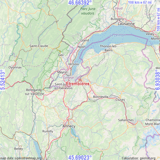
Étrembières GPS coordinates[2]
46° 10' 45.228" North, 6° 13' 38.1" East
| Map corner | latitude | longitude |
|---|---|---|
| Upper-left | 46.66392°, | 5.52413° |
| Center: | 46.17923°, | 6.22725° |
| Lower-right: | 45.69023°, | 6.93038° |
| Map W x H: | 108.3×108.3 km | = 67.3×67.3mi |
| max Lat: | 51.07786° ⇑63.9% North |
| Étrembières: | 46.17923° |
| min Lat: | ⇓36.1% South 41.3874° |
| min Long | Étrembières | max Long |
| -5.08615° | 6.22725° | 9.52242° |
| W 89.6%⇐ | ⇒10.4% E |
Elevation
Elevation of Étrembières is 427 m = 1401 ft, and this is 233.3 m = 765 ft above average elevation for this country.
| Max E: |
2333 m = 7654 ft | 10% |
| Étrembières | 427 m 1401 ft | |
| Avg. | 193.7 m = 635 ft | |
Min E: |
-1 m = -3 ft | 90% |
See also: France elevation on elevation.city.
Geographical zone
Étrembières is located in North temperate zone (between Tropic of Cancer and the Arctic Circle). Distance of this North polar circle is 2266.5 km =1408.3 mi to North.| Distance of | km | miles | from Étrembières |
|---|---|---|---|
| North Pole | 4872.4 | 3027.6 | to North |
| Arctic Circle | 2266.5 | 1408.3 | to North |
| Tropic Cancer | 2528.7 | 1571.3 | to South |
| Equator | 5134.6 | 3190.5 | to South |


Nearby cities:
15 places around Étrembières: (largest is in red/bold)
• Annemasse
1.9 km =1.2 mi,  25°
25°
• Arthaz-Pont-Notre-Dame
3.7 km =2.3 mi,  126°
126°
• Bonne
7.5 km =4.7 mi,  96°
96°
• Bossey
6.3 km =3.9 mi,  238°
238°
• Collonges-sous-Salève
7 km =4.3 mi,  233°
233°
• Cranves-Sales
5.6 km =3.5 mi,  80°
80°
• Gaillard
1.7 km =1.1 mi,  293°
293°
• Juvigny
5.8 km =3.6 mi,  46°
46°
• La Muraz
6.5 km =4 mi,  196°
196°
• Lucinges
6.9 km =4.3 mi, 78°
• Monnetier-Mornex
2.6 km =1.6 mi,  216°
216°
• Nangy
6.7 km =4.2 mi,  114°
114°
• Reignier-Ésery
5.9 km =3.7 mi,  149°
149°
• Ville-la-Grand
3.2 km =2 mi, 33°
• Vétraz-Monthoux
2.5 km =1.6 mi, 102°
Sources, notices
• [Note1] Compared only with cities in France existing in our database
• [Src1] Map data: © OpenStreetMap contributors (CC-BY-SA)
• [Src2] Other city data from geonames.org with taken over terms of usage.
• [Src3] Geographical zone / Annual Mean Temperature by Robert A. Rohde @ Wikipedia
