Essé geodata
Essé (Brittany) is a populated place; located in France in Europe/Paris (GMT+2) time zone. With population of 975 people, there are 9023 cities with bigger population in this country. Compared to other cities in France, 58.5% of cities are located further ↓South; 91.7% of cities are located further →East and 83.4% of cities have higher elevation than Essé. Note1
Administrative division(s):
- Level 1: Brittany
- Level 2: Département d'Ille-et-Vilaine
- Level 3: Arrondissement de Fougères-Vitré
- Level 4: Essé


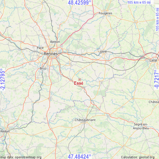
Essé GPS coordinates[2]
47° 57' 26.136" North, 1° 25' 29.388" West
| Map corner | latitude | longitude |
|---|---|---|
| Upper-left | 48.42599°, | -2.12795° |
| Center: | 47.95726°, | -1.42483° |
| Lower-right: | 47.48424°, | -0.7217° |
| Map W x H: | 104.7×104.7 km | = 65.1×65.1mi |
| max Lat: | 51.07786° ⇑41.5% North |
| Essé: | 47.95726° |
| min Lat: | ⇓58.5% South 41.3874° |
| min Long | Essé | max Long |
| -5.08615° | -1.42483° | 9.52242° |
| W 8.3%⇐ | ⇒91.7% E |
Elevation
Elevation of Essé is 46 m = 151 ft, and this is 147.7 m = 485 ft below average elevation for this country.
| Max E: |
2333 m = 7654 ft | 83.4% |
| Avg. | 193.7 m = 635 ft | |
| Essé | 46 m = 151 ft | |
Min E: |
-1 m = -3 ft | 16.6% |
See also: France elevation on elevation.city.
Geographical zone
Essé is located in North temperate zone (between Tropic of Cancer and the Arctic Circle). Distance of this North polar circle is 2068.8 km =1285.5 mi to North.| Distance of | km | miles | from Essé |
|---|---|---|---|
| North Pole | 4674.7 | 2904.7 | to North |
| Arctic Circle | 2068.8 | 1285.5 | to North |
| Tropic Cancer | 2726.4 | 1694.1 | to South |
| Equator | 5332.3 | 3313.3 | to South |


Nearby cities:
15 places around Essé: (largest is in red/bold)
• Amanlis
6.8 km =4.2 mi,  325°
325°
• Bais
11.6 km =7.2 mi,  59°
59°
• Boistrudan
2.2 km =1.4 mi,  50°
50°
• Brie
8.4 km =5.2 mi,  265°
265°
• Châteaugiron
11.5 km =7.1 mi, 329°
• Coësmes
8.3 km =5.2 mi,  188°
188°
• Janzé
5.5 km =3.4 mi, 272°
• Le Theil-de-Bretagne
4.2 km =2.6 mi,  184°
184°
• Marcillé-Robert
4.7 km =2.9 mi,  101°
101°
• Moulins
6.4 km =4 mi,  37°
37°
• Ossé
11.1 km =6.9 mi,  350°
350°
• Piré-sur-Seiche
5.8 km =3.6 mi,  356°
356°
• Retiers
5.9 km =3.7 mi,  145°
145°
• Saint-Aubin-du-Pavail
10 km =6.2 mi,  343°
343°
• Visseiche
9.2 km =5.7 mi,  91°
91°
Sources, notices
• [Note1] Compared only with cities in France existing in our database
• [Src1] Map data: © OpenStreetMap contributors (CC-BY-SA)
• [Src2] Other city data from geonames.org with taken over terms of usage.
• [Src3] Geographical zone / Annual Mean Temperature by Robert A. Rohde @ Wikipedia
