Courzieu geodata
Courzieu (Auvergne-Rhône-Alpes) is a populated place; located in France in Europe/Paris (GMT+2) time zone. With population of 1,205 people, there are 7504 cities with bigger population in this country. Compared to other cities in France, 70.2% of cities are located further ↑North; 72.6% of cities are located further ←West and 87.4% of cities have lower elevation than Courzieu. Note1
Administrative division(s):
- Level 1: Auvergne-Rhône-Alpes
- Level 2: Département du Rhône
- Level 3: Arrondissement de Villefranche-sur-Saône
- Level 4: Courzieu


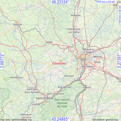
Courzieu GPS coordinates[2]
45° 44' 33.72" North, 4° 34' 15.024" East
| Map corner | latitude | longitude |
|---|---|---|
| Upper-left | 46.23124°, | 3.86772° |
| Center: | 45.7427°, | 4.57084° |
| Lower-right: | 45.24985°, | 5.27397° |
| Map W x H: | 109.1×109.1 km | = 67.8×67.8mi |
| max Lat: | 51.07786° ⇑70.2% North |
| Courzieu: | 45.7427° |
| min Lat: | ⇓29.8% South 41.3874° |
| min Long | Courzieu | max Long |
| -5.08615° | 4.57084° | 9.52242° |
| W 72.6%⇐ | ⇒27.4% E |
Elevation
Elevation of Courzieu is 380 m = 1247 ft, and this is 186.3 m = 611 ft above average elevation for this country.
| Max E: |
2333 m = 7654 ft | 12.6% |
| Courzieu | 380 m 1247 ft | |
| Avg. | 193.7 m = 635 ft | |
Min E: |
-1 m = -3 ft | 87.4% |
See also: France elevation on elevation.city.
Geographical zone
Courzieu is located in North temperate zone (between Tropic of Cancer and the Arctic Circle). Distance of this North polar circle is 2315.1 km =1438.5 mi to North.| Distance of | km | miles | from Courzieu |
|---|---|---|---|
| North Pole | 4921 | 3057.8 | to North |
| Arctic Circle | 2315.1 | 1438.5 | to North |
| Tropic Cancer | 2480.2 | 1541.1 | to South |
| Equator | 5086.1 | 3160.4 | to South |


Nearby cities:
15 places around Courzieu: (largest is in red/bold)
• Bessenay
4 km =2.5 mi,  341°
341°
• Brullioles
5.9 km =3.7 mi,  290°
290°
• Brussieu
3.6 km =2.2 mi,  279°
279°
• Chevinay
4.2 km =2.6 mi,  43°
43°
• Duerne
7.3 km =4.5 mi,  207°
207°
• Pollionnay
7.4 km =4.6 mi,  70°
70°
• Sain-Bel
7.8 km =4.8 mi,  15°
15°
• Saint-Genis-l’Argentière
7.1 km =4.4 mi,  239°
239°
• Saint-Julien-sur-Bibost
7.9 km =4.9 mi,  329°
329°
• Saint-Laurent-de-Chamousset
8.3 km =5.2 mi,  266°
266°
• Saint-Pierre-la-Palud
6.2 km =3.9 mi,  30°
30°
• Savigny
8.1 km =5 mi,  1°
1°
• Sourcieux-les-Mines
8.1 km =5 mi, 29°
• Thurins
8.7 km =5.4 mi,  141°
141°
• Vaugneray
6.7 km =4.2 mi,  94°
94°
Sources, notices
• [Note1] Compared only with cities in France existing in our database
• [Src1] Map data: © OpenStreetMap contributors (CC-BY-SA)
• [Src2] Other city data from geonames.org with taken over terms of usage.
• [Src3] Geographical zone / Annual Mean Temperature by Robert A. Rohde @ Wikipedia
