Saint-Genis-l’Argentière geodata
Saint-Genis-l’Argentière (Auvergne-Rhône-Alpes) is a populated place; located in France in Europe/Paris (GMT+2) time zone. With population of 919 people, there are 9496 cities with bigger population in this country. Compared to other cities in France, 70.7% of cities are located further ↑North; 72% of cities are located further ←West and 92.1% of cities have lower elevation than Saint-Genis-l’Argentière. Note1
Administrative division(s):
- Level 1: Auvergne-Rhône-Alpes
- Level 2: Département du Rhône
- Level 3: Arrondissement de Lyon
- Level 4: Saint-Genis-l'Argentière
Current local time in Saint-Genis-l’Argentière:
03:17 PM, SaturdayDifference from your time zone: hours


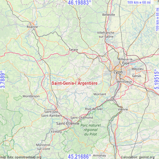
Saint-Genis-l’Argentière GPS coordinates[2]
45° 42' 36" North, 4° 29' 31.272" East
| Map corner | latitude | longitude |
|---|---|---|
| Upper-left | 46.19883°, | 3.7889° |
| Center: | 45.71°, | 4.49202° |
| Lower-right: | 45.21686°, | 5.19515° |
| Map W x H: | 109.2×109.2 km | = 67.9×67.9mi |
| max Lat: | 51.07786° ⇑70.7% North |
| Saint-Genis-l’Argentière: | 45.71° |
| min Lat: | ⇓29.3% South 41.3874° |
| min Long | Saint-Genis-l� | max Long |
| -5.08615° | 4.49202° | 9.52242° |
| W 72%⇐ | ⇒28% E |
Elevation
Elevation of Saint-Genis-l’Argentière is 479 m = 1572 ft, and this is 285.3 m = 936 ft above average elevation for this country.
| Max E: |
2333 m = 7654 ft | 7.9% |
| Saint-Genis-l’Argentière | 479 m 1572 ft | |
| Avg. | 193.7 m = 635 ft | |
Min E: |
-1 m = -3 ft | 92.1% |
See also: France elevation on elevation.city.
Geographical zone
Saint-Genis-l’Argentière is located in North temperate zone (between Tropic of Cancer and the Arctic Circle). Distance of this North polar circle is 2318.7 km =1440.8 mi to North.| Distance of | km | miles | from Saint-Genis-l’Argentière |
|---|---|---|---|
| North Pole | 4924.6 | 3060 | to North |
| Arctic Circle | 2318.7 | 1440.8 | to North |
| Tropic Cancer | 2476.6 | 1538.9 | to South |
| Equator | 5082.5 | 3158.1 | to South |


Nearby cities:
15 places around Saint-Genis-l’Argentière: (largest is in red/bold)
• Aveize
3.3 km =2.1 mi,  199°
199°
• Bessenay
8.8 km =5.5 mi,  33°
33°
• Brullioles
5.7 km =3.5 mi,  5°
5°
• Brussieu
4.9 km =3 mi, 30°
• Courzieu
7.1 km =4.4 mi,  59°
59°
• Duerne
3.9 km =2.4 mi,  135°
135°
• Grézieu-le-Marché
8.1 km =5 mi,  222°
222°
• Haute-Rivoire
7.5 km =4.7 mi,  274°
274°
• Meys
8.9 km =5.5 mi,  247°
247°
• Pomeys
7.7 km =4.8 mi,  209°
209°
• Saint-Clément-les-Places
7.1 km =4.4 mi,  311°
311°
• Saint-Laurent-de-Chamousset
3.8 km =2.4 mi,  325°
325°
• Saint-Martin-en-Haut
7.8 km =4.8 mi, 135°
• Sainte-Foy-l’Argentière
1.7 km =1.1 mi,  263°
263°
• Souzy
3.4 km =2.1 mi, 261°
Sources, notices
• [Note1] Compared only with cities in France existing in our database
• [Src1] Map data: © OpenStreetMap contributors (CC-BY-SA)
• [Src2] Other city data from geonames.org with taken over terms of usage.
• [Src3] Geographical zone / Annual Mean Temperature by Robert A. Rohde @ Wikipedia
