Conliège geodata
Conliège (Bourgogne-Franche-Comté) is a populated place; located in France in Europe/Paris (GMT+2) time zone. With population of 763 people, there are 11026 cities with bigger population in this country. Compared to other cities in France, 58.7% of cities are located further ↑North; 83.7% of cities are located further ←West and 82.8% of cities have lower elevation than Conliège. Note1
Administrative division(s):
- Level 1: Bourgogne-Franche-Comté
- Level 2: Jura
- Level 3: Arrondissement de Lons-le-Saunier
- Level 4: Conliège


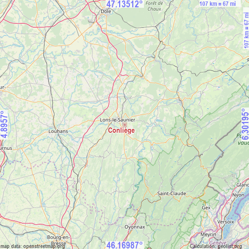
Conliège GPS coordinates[2]
46° 39' 16.74" North, 5° 35' 55.788" East
| Map corner | latitude | longitude |
|---|---|---|
| Upper-left | 47.13512°, | 4.8957° |
| Center: | 46.65465°, | 5.59883° |
| Lower-right: | 46.16987°, | 6.30195° |
| Map W x H: | 107.3×107.3 km | = 66.7×66.7mi |
| max Lat: | 51.07786° ⇑58.7% North |
| Conliège: | 46.65465° |
| min Lat: | ⇓41.3% South 41.3874° |
| min Long | Conliège | max Long |
| -5.08615° | 5.59883° | 9.52242° |
| W 83.7%⇐ | ⇒16.3% E |
Elevation
Elevation of Conliège is 319 m = 1047 ft, and this is 125.3 m = 411 ft above average elevation for this country.
| Max E: |
2333 m = 7654 ft | 17.2% |
| Conliège | 319 m 1047 ft | |
| Avg. | 193.7 m = 635 ft | |
Min E: |
-1 m = -3 ft | 82.8% |
See also: France elevation on elevation.city.
Geographical zone
Conliège is located in North temperate zone (between Tropic of Cancer and the Arctic Circle). Distance of this North polar circle is 2213.7 km =1375.5 mi to North.| Distance of | km | miles | from Conliège |
|---|---|---|---|
| North Pole | 4819.6 | 2994.8 | to North |
| Arctic Circle | 2213.7 | 1375.5 | to North |
| Tropic Cancer | 2581.6 | 1604.1 | to South |
| Equator | 5187.5 | 3223.4 | to South |


Nearby cities:
15 places around Conliège: (largest is in red/bold)
• Courbouzon
5.5 km =3.4 mi,  265°
265°
• Courlans
8.2 km =5.1 mi,  285°
285°
• Courlaoux
10.7 km =6.6 mi,  279°
279°
• Crançot
5.8 km =3.6 mi,  53°
53°
• Gevingey
7.4 km =4.6 mi,  254°
254°
• Lons-le-Saunier
4 km =2.5 mi,  304°
304°
• Macornay
4.4 km =2.7 mi,  257°
257°
• Messia-sur-Sorne
6.7 km =4.2 mi, 276°
• Montaigu
2.5 km =1.6 mi, 281°
• Montmorot
6.2 km =3.9 mi, 291°
• Perrigny
1.8 km =1.1 mi,  322°
322°
• Plainoiseau
9.3 km =5.8 mi,  339°
339°
• Pont-de-Poitte
10.3 km =6.4 mi,  136°
136°
• Saint-Germain-lès-Arlay
12.1 km =7.5 mi,  345°
345°
• Voiteur
11.1 km =6.9 mi,  4°
4°
Sources, notices
• [Note1] Compared only with cities in France existing in our database
• [Src1] Map data: © OpenStreetMap contributors (CC-BY-SA)
• [Src2] Other city data from geonames.org with taken over terms of usage.
• [Src3] Geographical zone / Annual Mean Temperature by Robert A. Rohde @ Wikipedia
