Commercy geodata
Commercy (Grand Est) is a seat of a third-order administrative division; located in France in Europe/Paris (GMT+2) time zone. With population of 7,138 people, there are 1363 cities with bigger population in this country. Compared to other cities in France, 74.6% of cities are located further ↓South; 83.7% of cities are located further ←West and 72.8% of cities have lower elevation than Commercy. Note1
Administrative division(s):
- Level 1: Grand Est
- Level 2: Meuse
- Level 3: Arrondissement de Commercy
- Level 4: Commercy


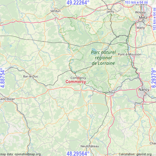
Commercy GPS coordinates[2]
48° 45' 40.608" North, 5° 35' 26.412" East
| Map corner | latitude | longitude |
|---|---|---|
| Upper-left | 49.22264°, | 4.88754° |
| Center: | 48.76128°, | 5.59067° |
| Lower-right: | 48.29564°, | 6.29379° |
| Map W x H: | 103.1×103.1 km | = 64.1×64.1mi |
| max Lat: | 51.07786° ⇑25.4% North |
| Commercy: | 48.76128° |
| min Lat: | ⇓74.6% South 41.3874° |
| min Long | Commercy | max Long |
| -5.08615° | 5.59067° | 9.52242° |
| W 83.7%⇐ | ⇒16.3% E |
Elevation
Elevation of Commercy is 235 m = 771 ft, and this is 41.3 m = 135 ft above average elevation for this country.
| Max E: |
2333 m = 7654 ft | 27.2% |
| Commercy | 235 m 771 ft | |
| Avg. | 193.7 m = 635 ft | |
Min E: |
-1 m = -3 ft | 72.8% |
See also: France elevation on elevation.city.
Geographical zone
Commercy is located in North temperate zone (between Tropic of Cancer and the Arctic Circle). Distance of this North polar circle is 1979.4 km =1229.9 mi to North.| Distance of | km | miles | from Commercy |
|---|---|---|---|
| North Pole | 4585.3 | 2849.2 | to North |
| Arctic Circle | 1979.4 | 1229.9 | to North |
| Tropic Cancer | 2815.8 | 1749.7 | to South |
| Equator | 5421.7 | 3368.9 | to South |


Nearby cities:
15 places around Commercy: (largest is in red/bold)
• Bruley
20.1 km =12.5 mi,  107°
107°
• Choloy-Ménillot
19.6 km =12.2 mi,  122°
122°
• Euville
2.9 km =1.8 mi, 115°
• Foug
16.8 km =10.4 mi, 120°
• Lucey
18.8 km =11.7 mi,  103°
103°
• Lérouville
5.1 km =3.2 mi,  313°
313°
• Pagny-sur-Meuse
12.4 km =7.7 mi,  131°
131°
• Saint-Mihiel
14.3 km =8.9 mi,  348°
348°
• Sampigny
9.4 km =5.8 mi,  321°
321°
• Sorcy-Saint-Martin
6.2 km =3.9 mi,  149°
149°
• Trondes
14.3 km =8.9 mi, 110°
• Vacon
10.3 km =6.4 mi,  176°
176°
• Vaucouleurs
18.4 km =11.4 mi,  162°
162°
• Vignot
2 km =1.2 mi,  43°
43°
• Void-Vacon
8.9 km =5.5 mi,  167°
167°
Sources, notices
• [Note1] Compared only with cities in France existing in our database
• [Src1] Map data: © OpenStreetMap contributors (CC-BY-SA)
• [Src2] Other city data from geonames.org with taken over terms of usage.
• [Src3] Geographical zone / Annual Mean Temperature by Robert A. Rohde @ Wikipedia
