Lérouville geodata
Lérouville (Grand Est) is a populated place; located in France in Europe/Paris (GMT+2) time zone. With population of 1,408 people, there are 6574 cities with bigger population in this country. Compared to other cities in France, 75.4% of cities are located further ↓South; 83.2% of cities are located further ←West and 71.7% of cities have lower elevation than Lérouville. Note1
Administrative division(s):
- Level 1: Grand Est
- Level 2: Meuse
- Level 3: Arrondissement de Commercy
- Level 4: Lérouville


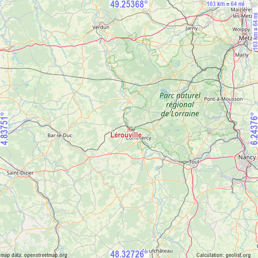
Lérouville GPS coordinates[2]
48° 47' 33.396" North, 5° 32' 26.268" East
| Map corner | latitude | longitude |
|---|---|---|
| Upper-left | 49.25368°, | 4.83751° |
| Center: | 48.79261°, | 5.54063° |
| Lower-right: | 48.32726°, | 6.24376° |
| Map W x H: | 103×103 km | = 64×64mi |
| max Lat: | 51.07786° ⇑24.6% North |
| Lérouville: | 48.79261° |
| min Lat: | ⇓75.4% South 41.3874° |
| min Long | Lérouville | max Long |
| -5.08615° | 5.54063° | 9.52242° |
| W 83.2%⇐ | ⇒16.8% E |
Elevation
Elevation of Lérouville is 228 m = 748 ft, and this is 34.3 m = 113 ft above average elevation for this country.
| Max E: |
2333 m = 7654 ft | 28.3% |
| Lérouville | 228 m 748 ft | |
| Avg. | 193.7 m = 635 ft | |
Min E: |
-1 m = -3 ft | 71.7% |
See also: France elevation on elevation.city.
Geographical zone
Lérouville is located in North temperate zone (between Tropic of Cancer and the Arctic Circle). Distance of this North polar circle is 1975.9 km =1227.8 mi to North.| Distance of | km | miles | from Lérouville |
|---|---|---|---|
| North Pole | 4581.8 | 2847 | to North |
| Arctic Circle | 1975.9 | 1227.8 | to North |
| Tropic Cancer | 2819.3 | 1751.8 | to South |
| Equator | 5425.2 | 3371.1 | to South |


Nearby cities:
15 places around Lérouville: (largest is in red/bold)
• Commercy
5.1 km =3.2 mi,  133°
133°
• Euville
7.8 km =4.8 mi, 126°
• Foug
21.8 km =13.5 mi,  123°
123°
• Lacroix-sur-Meuse
20.2 km =12.6 mi,  353°
353°
• Ligny-en-Barrois
19.6 km =12.2 mi,  233°
233°
• Pagny-sur-Meuse
17.5 km =10.9 mi, 131°
• Saint-Mihiel
10.6 km =6.6 mi,  4°
4°
• Sampigny
4.5 km =2.8 mi,  330°
330°
• Sorcy-Saint-Martin
11.1 km =6.9 mi,  142°
142°
• Trondes
19.1 km =11.9 mi, 116°
• Tronville-en-Barrois
20.9 km =13 mi,  247°
247°
• Vacon
14.5 km =9 mi,  162°
162°
• Velaines
20.2 km =12.6 mi,  238°
238°
• Vignot
5.4 km =3.4 mi,  112°
112°
• Void-Vacon
13.4 km =8.3 mi, 155°
Sources, notices
• [Note1] Compared only with cities in France existing in our database
• [Src1] Map data: © OpenStreetMap contributors (CC-BY-SA)
• [Src2] Other city data from geonames.org with taken over terms of usage.
• [Src3] Geographical zone / Annual Mean Temperature by Robert A. Rohde @ Wikipedia
