Clary geodata
Clary (Hauts-de-France) is a populated place; located in France in Europe/Paris (GMT+2) time zone. With population of 1,128 people, there are 7959 cities with bigger population in this country. Compared to other cities in France, 94% of cities are located further ↓South; 63.2% of cities are located further ←West and 51.2% of cities have higher elevation than Clary. Note1
Administrative division(s):
- Level 1: Hauts-de-France
- Level 2: Nord
- Level 3: Arrondissement de Cambrai
- Level 4: Clary


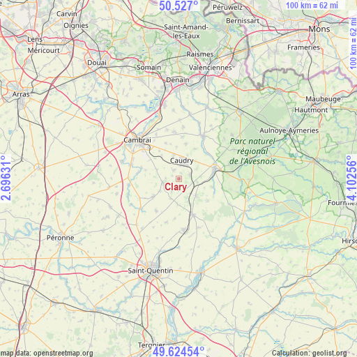
Clary GPS coordinates[2]
50° 4' 40.404" North, 3° 23' 57.948" East
| Map corner | latitude | longitude |
|---|---|---|
| Upper-left | 50.527°, | 2.69631° |
| Center: | 50.07789°, | 3.39943° |
| Lower-right: | 49.62454°, | 4.10256° |
| Map W x H: | 100.3×100.3 km | = 62.3×62.3mi |
| max Lat: | 51.07786° ⇑6% North |
| Clary: | 50.07789° |
| min Lat: | ⇓94% South 41.3874° |
| min Long | Clary | max Long |
| -5.08615° | 3.39943° | 9.52242° |
| W 63.2%⇐ | ⇒36.8% E |
Elevation
Elevation of Clary is 128 m = 420 ft, and this is 65.7 m = 216 ft below average elevation for this country.
| Max E: |
2333 m = 7654 ft | 51.2% |
| Avg. | 193.7 m = 635 ft | |
| Clary | 128 m = 420 ft | |
Min E: |
-1 m = -3 ft | 48.8% |
See also: France elevation on elevation.city.
Geographical zone
Clary is located in North temperate zone (between Tropic of Cancer and the Arctic Circle). Distance of this North polar circle is 1833 km =1139 mi to North.| Distance of | km | miles | from Clary |
|---|---|---|---|
| North Pole | 4438.9 | 2758.2 | to North |
| Arctic Circle | 1833 | 1139 | to North |
| Tropic Cancer | 2962.2 | 1840.6 | to South |
| Equator | 5568.1 | 3459.9 | to South |


Nearby cities:
15 places around Clary: (largest is in red/bold)
• Beauvois-en-Cambrésis
6.8 km =4.2 mi,  347°
347°
• Bertry
3.3 km =2.1 mi,  71°
71°
• Busigny
6.8 km =4.2 mi,  135°
135°
• Caudry
5.3 km =3.3 mi,  9°
9°
• Esnes
6.6 km =4.1 mi,  292°
292°
• Fontaine-au-Pire
6.3 km =3.9 mi, 345°
• Honnechy
5.2 km =3.2 mi,  100°
100°
• Inchy
6.8 km =4.2 mi,  43°
43°
• Ligny-en-Cambrésis
3 km =1.9 mi,  329°
329°
• Maretz
3.9 km =2.4 mi,  159°
159°
• Montigny-en-Cambrésis
1.7 km =1.1 mi,  32°
32°
• Selvigny
3.6 km =2.2 mi,  273°
273°
• Troisvilles
5.9 km =3.7 mi,  59°
59°
• Walincourt-Selvigny
4.9 km =3 mi,  255°
255°
• Élincourt
4.2 km =2.6 mi,  208°
208°
Sources, notices
• [Note1] Compared only with cities in France existing in our database
• [Src1] Map data: © OpenStreetMap contributors (CC-BY-SA)
• [Src2] Other city data from geonames.org with taken over terms of usage.
• [Src3] Geographical zone / Annual Mean Temperature by Robert A. Rohde @ Wikipedia
