Honnechy geodata
Honnechy (Hauts-de-France) is a populated place; located in France in Europe/Paris (GMT+2) time zone. With population of 511 people, there are 15016 cities with bigger population in this country. Compared to other cities in France, 94% of cities are located further ↓South; 64% of cities are located further ←West and 52.5% of cities have lower elevation than Honnechy. Note1
Administrative division(s):
- Level 1: Hauts-de-France
- Level 2: Nord
- Level 3: Arrondissement de Cambrai
- Level 4: Honnechy


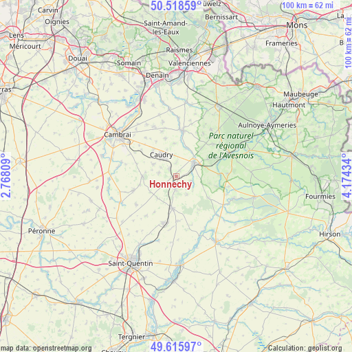
Honnechy GPS coordinates[2]
50° 4' 9.84" North, 3° 28' 16.356" East
| Map corner | latitude | longitude |
|---|---|---|
| Upper-left | 50.51859°, | 2.76809° |
| Center: | 50.0694°, | 3.47121° |
| Lower-right: | 49.61597°, | 4.17434° |
| Map W x H: | 100.4×100.4 km | = 62.4×62.4mi |
| max Lat: | 51.07786° ⇑6% North |
| Honnechy: | 50.0694° |
| min Lat: | ⇓94% South 41.3874° |
| min Long | Honnechy | max Long |
| -5.08615° | 3.47121° | 9.52242° |
| W 64%⇐ | ⇒36% E |
Elevation
Elevation of Honnechy is 141 m = 463 ft, and this is 52.7 m = 173 ft below average elevation for this country.
| Max E: |
2333 m = 7654 ft | 47.5% |
| Avg. | 193.7 m = 635 ft | |
| Honnechy | 141 m = 463 ft | |
Min E: |
-1 m = -3 ft | 52.5% |
See also: France elevation on elevation.city.
Geographical zone
Honnechy is located in North temperate zone (between Tropic of Cancer and the Arctic Circle). Distance of this North polar circle is 1834 km =1139.6 mi to North.| Distance of | km | miles | from Honnechy |
|---|---|---|---|
| North Pole | 4439.9 | 2758.8 | to North |
| Arctic Circle | 1834 | 1139.6 | to North |
| Tropic Cancer | 2961.3 | 1840.1 | to South |
| Equator | 5567.2 | 3459.3 | to South |


Nearby cities:
15 places around Honnechy: (largest is in red/bold)
• Bertry
2.8 km =1.7 mi,  314°
314°
• Busigny
3.9 km =2.4 mi,  184°
184°
• Béthencourt
7.9 km =4.9 mi,  339°
339°
• Caudry
7.5 km =4.7 mi,  325°
325°
• Clary
5.2 km =3.2 mi,  280°
280°
• Inchy
5.9 km =3.7 mi,  355°
355°
• Ligny-en-Cambrésis
7.5 km =4.7 mi,  298°
298°
• Maretz
4.6 km =2.9 mi,  234°
234°
• Montigny-en-Cambrésis
4.8 km =3 mi, 299°
• Neuvilly
8.7 km =5.4 mi,  20°
20°
• Prémont
8.3 km =5.2 mi,  223°
223°
• Saint-Souplet
4.6 km =2.9 mi,  108°
108°
• Troisvilles
4 km =2.5 mi, 358°
• Vaux-Andigny
6.1 km =3.8 mi,  147°
147°
• Élincourt
7.6 km =4.7 mi,  248°
248°
Sources, notices
• [Note1] Compared only with cities in France existing in our database
• [Src1] Map data: © OpenStreetMap contributors (CC-BY-SA)
• [Src2] Other city data from geonames.org with taken over terms of usage.
• [Src3] Geographical zone / Annual Mean Temperature by Robert A. Rohde @ Wikipedia
