Chasselay geodata
Chasselay (Auvergne-Rhône-Alpes) is a populated place; located in France in Europe/Paris (GMT+2) time zone. With population of 2,746 people, there are 3566 cities with bigger population in this country. Compared to other cities in France, 68.1% of cities are located further ↑North; 74.7% of cities are located further ←West and 78.9% of cities have lower elevation than Chasselay. Note1
Administrative division(s):
- Level 1: Auvergne-Rhône-Alpes
- Level 2: Département du Rhône
- Level 3: Arrondissement de Villefranche-sur-Saône
- Level 4: Chasselay


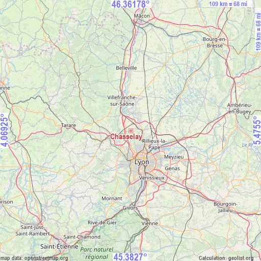
Chasselay GPS coordinates[2]
45° 52' 27.84" North, 4° 46' 20.532" East
| Map corner | latitude | longitude |
|---|---|---|
| Upper-left | 46.36178°, | 4.06925° |
| Center: | 45.8744°, | 4.77237° |
| Lower-right: | 45.3827°, | 5.4755° |
| Map W x H: | 108.9×108.9 km | = 67.7×67.7mi |
| max Lat: | 51.07786° ⇑68.1% North |
| Chasselay: | 45.8744° |
| min Lat: | ⇓31.9% South 41.3874° |
| min Long | Chasselay | max Long |
| -5.08615° | 4.77237° | 9.52242° |
| W 74.7%⇐ | ⇒25.3% E |
Elevation
Elevation of Chasselay is 280 m = 919 ft, and this is 86.3 m = 283 ft above average elevation for this country.
| Max E: |
2333 m = 7654 ft | 21.1% |
| Chasselay | 280 m 919 ft | |
| Avg. | 193.7 m = 635 ft | |
Min E: |
-1 m = -3 ft | 78.9% |
See also: France elevation on elevation.city.
Geographical zone
Chasselay is located in North temperate zone (between Tropic of Cancer and the Arctic Circle). Distance of this North polar circle is 2300.4 km =1429.4 mi to North.| Distance of | km | miles | from Chasselay |
|---|---|---|---|
| North Pole | 4906.3 | 3048.6 | to North |
| Arctic Circle | 2300.4 | 1429.4 | to North |
| Tropic Cancer | 2494.8 | 1550.2 | to South |
| Equator | 5100.8 | 3169.5 | to South |


Nearby cities:
15 places around Chasselay: (largest is in red/bold)
• Albigny-sur-Saône
4.8 km =3 mi,  100°
100°
• Couzon-au-Mont-d’Or
5.5 km =3.4 mi,  127°
127°
• Dommartin
6.4 km =4 mi,  227°
227°
• Fleurieu-sur-Saône
5.9 km =3.7 mi, 104°
• Genay
5.9 km =3.7 mi,  64°
64°
• Les Chères
2.9 km =1.8 mi,  306°
306°
• Limonest
4.2 km =2.6 mi,  180°
180°
• Lissieu
2.6 km =1.6 mi,  245°
245°
• Lucenay
6.9 km =4.3 mi, 308°
• Massieux
6.1 km =3.8 mi,  49°
49°
• Morancé
6.2 km =3.9 mi,  295°
295°
• Neuville-sur-Saône
5.3 km =3.3 mi,  87°
87°
• Parcieux
6.2 km =3.9 mi,  40°
40°
• Quincieux
4.4 km =2.7 mi,  4°
4°
• Rochetaillée-sur-Saône
6.6 km =4.1 mi,  114°
114°
Sources, notices
• [Note1] Compared only with cities in France existing in our database
• [Src1] Map data: © OpenStreetMap contributors (CC-BY-SA)
• [Src2] Other city data from geonames.org with taken over terms of usage.
• [Src3] Geographical zone / Annual Mean Temperature by Robert A. Rohde @ Wikipedia
