Bonnétable geodata
Bonnétable (Pays de la Loire) is a populated place; located in France in Europe/Paris (GMT+2) time zone. With population of 4,198 people, there are 2343 cities with bigger population in this country. Compared to other cities in France, 62.5% of cities are located further ↓South; 74% of cities are located further →East and 58.7% of cities have higher elevation than Bonnétable. Note1
Administrative division(s):
- Level 1: Pays de la Loire
- Level 2: Sarthe
- Level 3: Arrondissement de Mamers
- Level 4: Bonnétable


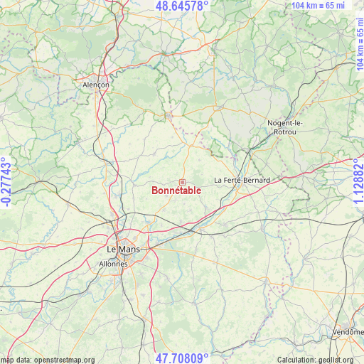
Bonnétable GPS coordinates[2]
48° 10' 44.688" North, 0° 25' 32.52" East
| Map corner | latitude | longitude |
|---|---|---|
| Upper-left | 48.64578°, | -0.27743° |
| Center: | 48.17908°, | 0.4257° |
| Lower-right: | 47.70809°, | 1.12882° |
| Map W x H: | 104.3×104.3 km | = 64.8×64.8mi |
| max Lat: | 51.07786° ⇑37.5% North |
| Bonnétable: | 48.17908° |
| min Lat: | ⇓62.5% South 41.3874° |
| min Long | Bonnétable | max Long |
| -5.08615° | 0.4257° | 9.52242° |
| W 26%⇐ | ⇒74% E |
Elevation
Elevation of Bonnétable is 106 m = 348 ft, and this is 87.7 m = 288 ft below average elevation for this country.
| Max E: |
2333 m = 7654 ft | 58.7% |
| Avg. | 193.7 m = 635 ft | |
| Bonnétable | 106 m = 348 ft | |
Min E: |
-1 m = -3 ft | 41.3% |
See also: France elevation on elevation.city.
Geographical zone
Bonnétable is located in North temperate zone (between Tropic of Cancer and the Arctic Circle). Distance of this North polar circle is 2044.2 km =1270.2 mi to North.| Distance of | km | miles | from Bonnétable |
|---|---|---|---|
| North Pole | 4650.1 | 2889.4 | to North |
| Arctic Circle | 2044.2 | 1270.2 | to North |
| Tropic Cancer | 2751.1 | 1709.5 | to South |
| Equator | 5357 | 3328.7 | to South |


Nearby cities:
15 places around Bonnétable: (largest is in red/bold)
• Ballon
13.9 km =8.6 mi,  267°
267°
• Beaufay
5.9 km =3.7 mi,  232°
232°
• Boëssé-le-Sec
11.4 km =7.1 mi,  115°
115°
• Courcemont
5.4 km =3.4 mi,  262°
262°
• La Chapelle-Saint-Rémy
8.3 km =5.2 mi,  163°
163°
• La Chapelle-du-Bois
13.3 km =8.3 mi,  68°
68°
• Lombron
11.2 km =7 mi,  182°
182°
• Marolles-les-Braults
11.5 km =7.1 mi,  315°
315°
• Nogent-le-Bernard
7.9 km =4.9 mi,  36°
36°
• Saint-Aubin-des-Coudrais
11.9 km =7.4 mi,  94°
94°
• Saint-Cosme-en-Vairais
10.2 km =6.3 mi,  17°
17°
• Saint-Mars-sous-Ballon
13.3 km =8.3 mi, 266°
• Sillé-le-Philippe
9.8 km =6.1 mi,  214°
214°
• Torcé-en-Vallée
5.7 km =3.5 mi,  202°
202°
• Tuffé
9.9 km =6.2 mi,  137°
137°
Sources, notices
• [Note1] Compared only with cities in France existing in our database
• [Src1] Map data: © OpenStreetMap contributors (CC-BY-SA)
• [Src2] Other city data from geonames.org with taken over terms of usage.
• [Src3] Geographical zone / Annual Mean Temperature by Robert A. Rohde @ Wikipedia
