Nogent-le-Bernard geodata
Nogent-le-Bernard (Pays de la Loire) is a populated place; located in France in Europe/Paris (GMT+2) time zone. With population of 903 people, there are 9626 cities with bigger population in this country. Compared to other cities in France, 63.5% of cities are located further ↓South; 73.5% of cities are located further →East and 55.6% of cities have higher elevation than Nogent-le-Bernard. Note1
Administrative division(s):
- Level 1: Pays de la Loire
- Level 2: Sarthe
- Level 3: Arrondissement de Mamers
- Level 4: Nogent-le-Bernard


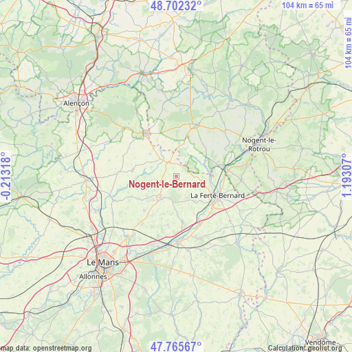
Nogent-le-Bernard GPS coordinates[2]
48° 14' 10.104" North, 0° 29' 23.82" East
| Map corner | latitude | longitude |
|---|---|---|
| Upper-left | 48.70232°, | -0.21318° |
| Center: | 48.23614°, | 0.48995° |
| Lower-right: | 47.76567°, | 1.19307° |
| Map W x H: | 104.1×104.1 km | = 64.7×64.7mi |
| max Lat: | 51.07786° ⇑36.5% North |
| Nogent-le-Bernard: | 48.23614° |
| min Lat: | ⇓63.5% South 41.3874° |
| min Long | Nogent-le-Berna | max Long |
| -5.08615° | 0.48995° | 9.52242° |
| W 26.5%⇐ | ⇒73.5% E |
Elevation
Elevation of Nogent-le-Bernard is 115 m = 377 ft, and this is 78.7 m = 258 ft below average elevation for this country.
| Max E: |
2333 m = 7654 ft | 55.6% |
| Avg. | 193.7 m = 635 ft | |
| Nogent-le-Bernard | 115 m = 377 ft | |
Min E: |
-1 m = -3 ft | 44.4% |
See also: France elevation on elevation.city.
Geographical zone
Nogent-le-Bernard is located in North temperate zone (between Tropic of Cancer and the Arctic Circle). Distance of this North polar circle is 2037.8 km =1266.2 mi to North.| Distance of | km | miles | from Nogent-le-Bernard |
|---|---|---|---|
| North Pole | 4643.7 | 2885.5 | to North |
| Arctic Circle | 2037.8 | 1266.2 | to North |
| Tropic Cancer | 2757.4 | 1713.4 | to South |
| Equator | 5363.4 | 3332.7 | to South |


Nearby cities:
15 places around Nogent-le-Bernard: (largest is in red/bold)
• Beaufay
13.7 km =8.5 mi,  223°
223°
• Bonnétable
7.9 km =4.9 mi, 216°
• Boëssé-le-Sec
12.5 km =7.8 mi,  154°
154°
• Courcemont
12.3 km =7.6 mi,  235°
235°
• Igé
10.1 km =6.3 mi,  13°
13°
• La Chapelle-du-Bois
7.8 km =4.8 mi,  101°
101°
• La Ferté-Bernard
13.3 km =8.3 mi,  114°
114°
• Marolles-les-Braults
13 km =8.1 mi,  278°
278°
• Préval
10 km =6.2 mi,  90°
90°
• Saint-Aubin-des-Coudrais
10.1 km =6.3 mi,  135°
135°
• Saint-Cosme-en-Vairais
3.8 km =2.4 mi,  333°
333°
• Saint-Germain-de-la-Coudre
9.9 km =6.2 mi,  59°
59°
• Saint-Rémy-des-Monts
10.5 km =6.5 mi,  320°
320°
• Torcé-en-Vallée
13.5 km =8.4 mi,  210°
210°
• Tuffé
13.8 km =8.6 mi,  172°
172°
Sources, notices
• [Note1] Compared only with cities in France existing in our database
• [Src1] Map data: © OpenStreetMap contributors (CC-BY-SA)
• [Src2] Other city data from geonames.org with taken over terms of usage.
• [Src3] Geographical zone / Annual Mean Temperature by Robert A. Rohde @ Wikipedia
